When published in 1611/12, his atlas was an immediate success, outdoing the one established by Christopher Saxton in 1579. There were a number reasons for this: Speed’s atlas showed each county separately with its hundreds, was resplendent with heraldic shields but most significantly had one or two town plans. Displayed from a bird’s eye view perspective, many of the towns were surveyed by Speed himself using a distinct ‘scale of paces’ and are the earliest known plans of these places. The aesthetic beauty of the maps were also down to the Dutch engraver, Jodocus Hondius, whose fine calligraphy and decorative strapwork are a feature throughout.
Speed’s legacy was to live on long after his passing, the ‘ Theatre’ itself was published in many editions until 1676. The maps were then re-published in the early 18th Century by Henry Overton and then finally in the 1780s by Dicey & co. giving them a life of 170 years.
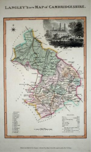
- This is an original copperplate engraving with old hand colour.
- Printed area is approximately 51.8cms by 38.2cms.
- The map is in very good condition; central fold, as issued. The left margin is close, as issued, but still mountable without loss. Minor repairs / strengthening to the fold. Click on image for a better view.
- Click on ‘Delivery Policy’ for postage costs.
- Guaranteed to be over 340 years old.