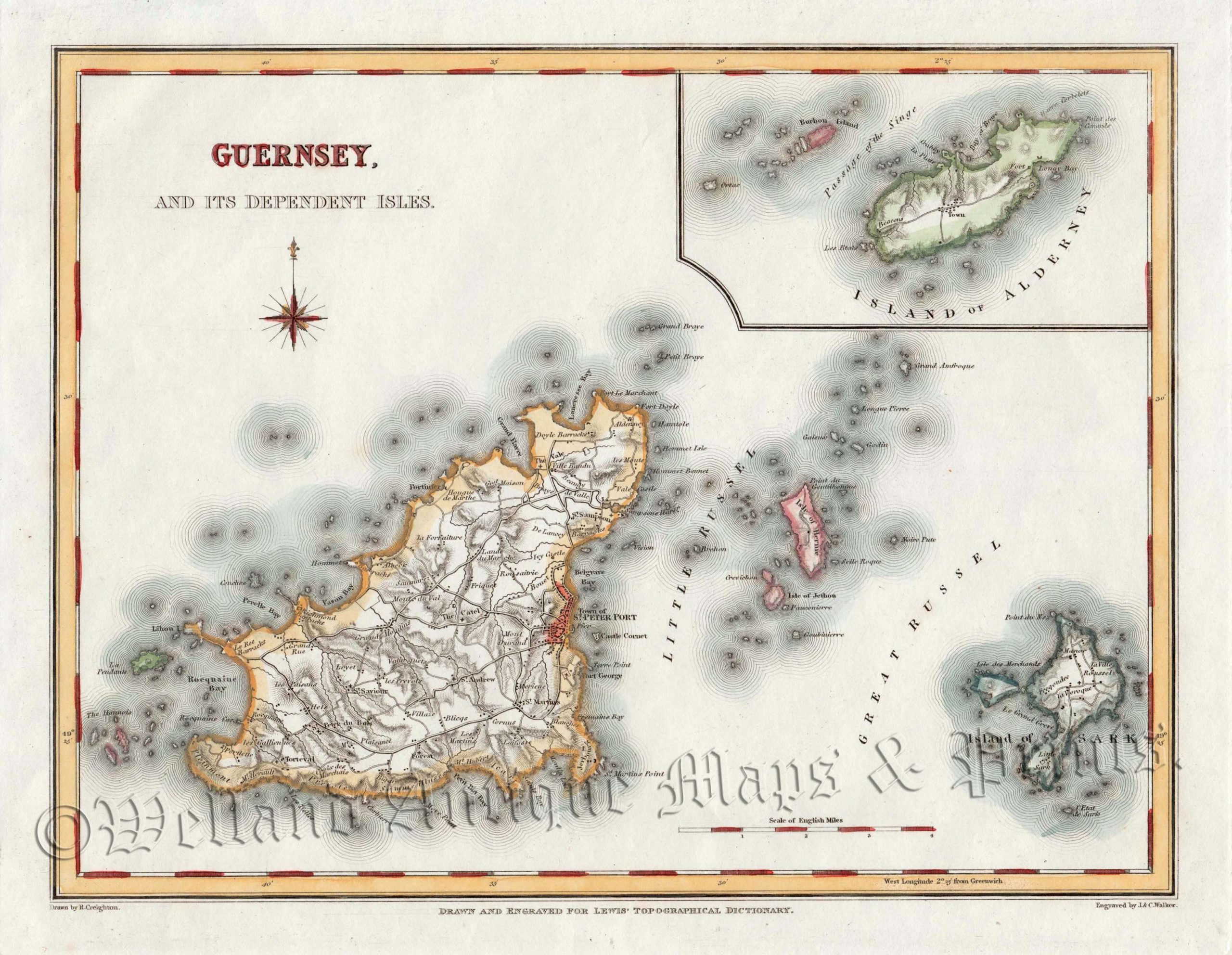
An interesting 19th Century map of Guernsey and Sark — with an inset of Alderney — which was drawn and engraved by R. Creighton and J. & C. Walker, respectively, and published in Samuel Lewis’s English Topographical Dictionary (London: S. Lewis, 1840-1849).
- This is an original steel engraving with original and later hand colour.
- Printed area is approximately 23.3cms by 18.3cms.
- The map is in very good condition with decent margins. There is a repair to the bottom paper border which is well away from the printed area. Click on image for a better view.
- Click on ‘Delivery Policy’ for postage costs.
- Guaranteed to be over 160 years old.