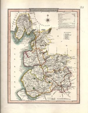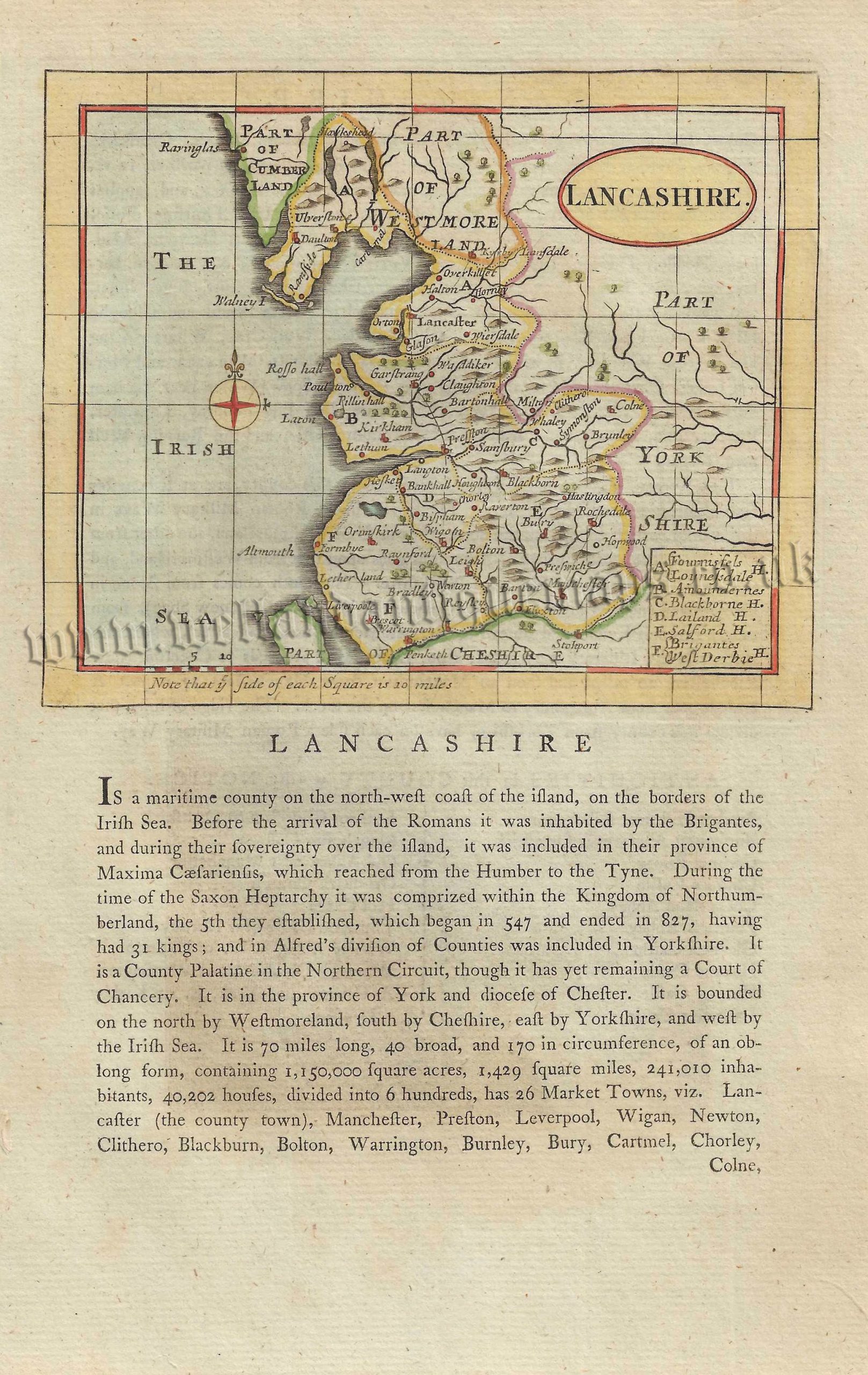
An interesting and attractive late 18th century map of Lancashire which appeared in Francis Grose’s The Antiquities of England and Wales (London: S. Hooper, 1787-c.1815).
The maps from this series were originally engraved in c.1694 for John Seller’s Anglia Contracta. Seller (fl. 1660-1697) was a noted map maker and publisher of the time, particularly for his sea charts — interestingly, financial difficulties had seen him produce the Anglia Contracta to revive his fortunes.
Nearly a century later, the plates were given a new lease of life when they were amended and printed on a page of historical text for Francis Grose’s Antiquities series. Grose (c.1731-1791), a former Richmond Herald and Militia Captain, was one of the most renowned historical writers of the period. The Antiquities series proved popular with Grose’s contemporaries and was published in several editions well into the 19th century.
- This is an original copperplate engraving with later hand colour.
- Printed area, with text, is approximately 14.7cms by 20.9cms.
- The map is in very good condition with adequate margins. Click on image for a better view.
- The item comes displayed (window mounted both sides) in a ready to frame museum quality mount.
- Click on ‘Delivery Policy’ for postage costs.
- Guaranteed to be over 200 years old.