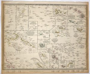
An interesting and attractive 19th century map of the Islands of Tahiti which appeared in Jules Dumont d’Urville’s* Voyage pittoresque autour du Monde (Paris: 1834/1835).
*Jules Sébastien César Dumont d’Urville (23 May 1790 ? 8 May 1842) was a French explorer, navigator and rear admiral, who explored the south and western Pacific Australia, New Zealand and Antarctica. As a botanist and cartographer he left his mark, giving his name to several seaweeds, plants and shrubs, and places such as D’Urville Island.
- This is an original steel engraving with later hand colour.
- Printed area is approximately 32.8cms by 22.3cms (including imprint).
- The engraving is in very good condition with decent margins; vertical folds, as issued. Click on image for a better view.
- Click on ‘Delivery Policy’ for postage costs.
- Guaranteed to be over 170 years old.


