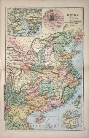
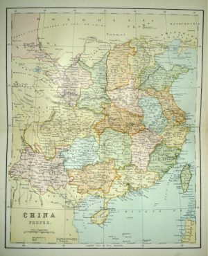
A very attractive and interesting Edwardian map of China and Tibet — with inset plans of Hong Kong and Hong Kong Harbour — which was produced by Philip & Son Ltd and The London Geographical Institute for The Harmsworth Universal Atlas and Gazeteer (London: Amalgamated Press Limited, 1907).
- This is an original chromolithograph.
- Printed area is approximately 48.4cms by 38.4cms (including title & imprint).
- The item is in very good condition with decent margins; centre fold, as issued. Click on image for a better view.
- Click on ‘Delivery Policy’ for postage costs.
- Guaranteed to be over 100 years old.