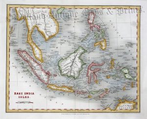
A very finely engraved, detailed and attractive 19th century map of East Asia — including Indo-China, Indonesia, Philippines, Burma/Myanmar and South China — which was published in Black’s General Atlas: A series of Fifty-Four Maps from the Latest and Most Authentic Sources (Edinburgh: A. & C. Black,1843).
- This is an original steel engraving with original outline hand colour.
- Printed area is approximately 25.5cms by 36.6cms.
- The engraving is in very good condition with decent margins. A couple of minor spots. Click on image for a better view.
- Click on ‘Delivery Policy’ for postage costs.
- Guaranteed to be over 170 years old.