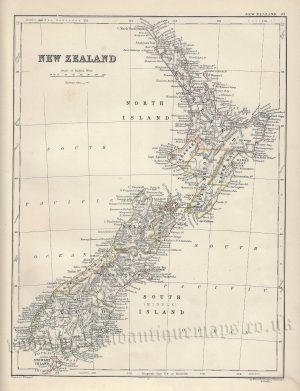
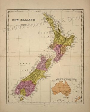
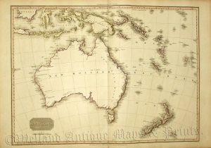
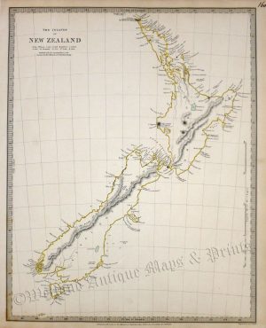
A very interesting and finely engraved 19th century map of New Zealand — with insets of Western Australia and Tasmania / Van Diemen’s Land — which was engraved by W. Hughes and published in Black’s General Atlas: A series of Fifty-Four Maps from the Latest and Most Authentic Sources (Edinburgh: A. & C. Black,1844-1850). This is amongst the earliest detailed maps of New Zealand and still shows it as largely unexplored.
- This is an original steel engraving with original hand colour.
- Printed area is approximately 27.9cms by 39.7cms (including imprint).
- The engraving is in very good condition with decent margins. Click on image for a better view.
- Click on ‘Delivery Policy’ for postage costs.
- Guaranteed to be over 170 years old.