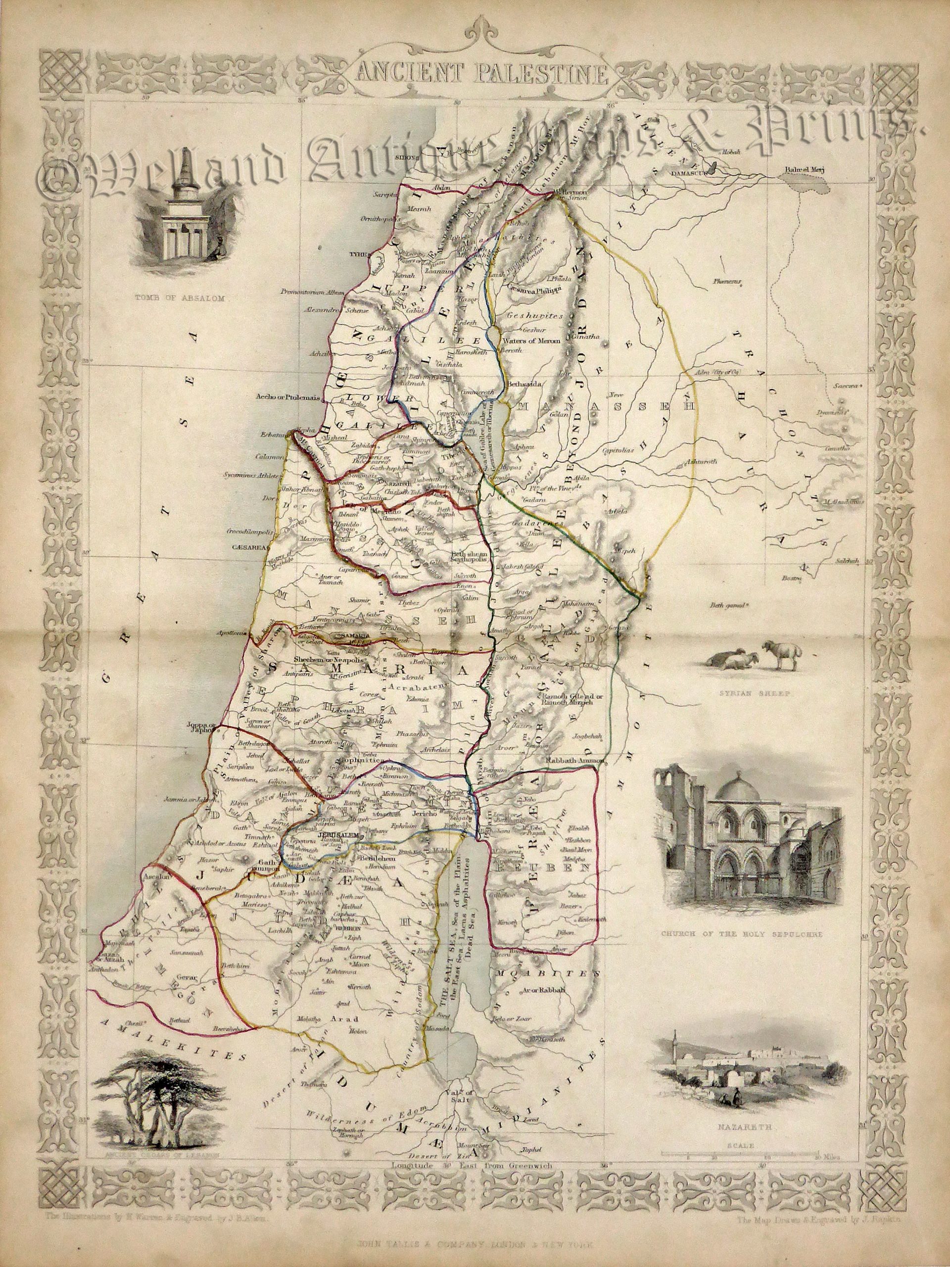
A decorative and detailed mid 19th century map of ‘Ancient Palestine’ which was drawn and engraved by J. Rapkin (vignettes by H. Warren & J. B. Allen) and published in John Tallis’s Illustrated Atlas (London & New York: John Tallis & co, c.1851).
The Illustrated Atlas, published from 1849 to 1853, was the last decorative world atlas. The ‘MAncient Palestine’ map was typical of the many fine ones which appeared in this work with its decorative border and attractive vignettes. Illustrated are views of the Tomb of Absalom, the ancient cedars of Lebanon, the Church of the Holy Sepulchre, the City of Nazareth and Syrian sheep.
- This is an original steel engraving with original hand colour.
- Printed area is approximately 24.6cms by 34.7cms (including imprint).
- The map is in very good condition with decent margins; centrefold, as issued. Click on image for a better view.
- Click on ‘Delivery Policy’ for postage costs.
- Guaranteed to be over 160 years old.