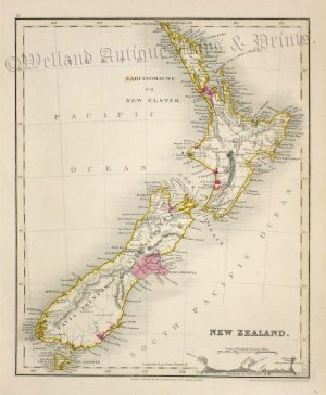
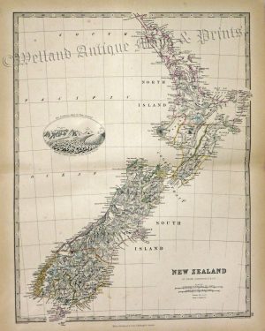
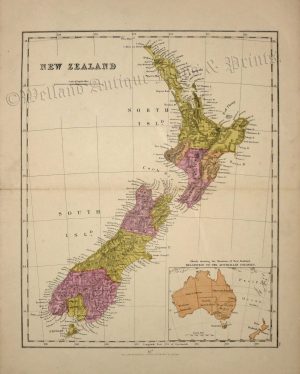
A very interesting late 18th century map of New Zealand — with inset plans of the bays — which was produced by Rigobert Bonne (engraver: André) and published in Guillaume Raynal’s Atlas de toutes les parties connues du globe terrestre (Geneva: 1780). Issued in the years after Captain Cook’s landing in 1769, this is one of the earliest maps of New Zealand that can be acquired at an affordable price.
Rigobert Bonne (1727-1795) was one of the most important cartographers of the late 18th century. In 1773, he succeeded Jacques Nicolas Bellin as Royal Cartographer to France in the office of the Hydrographer at the Depôt de la Marine. Working in his official capacity, Bonne compiled some of the most detailed and accurate maps of the period. Bonne’s work represented an important step in the evolution of the cartographic ideology away from the decorative work of the 17th and early 18th century towards a more detail oriented and practical aesthetic. With regard to the rendering of terrain, Bonne maps bear many stylistic similarities to those of his predecessor, Bellin; however, Bonne maps generally abandon such common 18th century decorative features such as elaborate cartouches and compass roses. While mostly focusing on coastal regions, the work of Bonne is highly regarded for its detail, historical importance, and overall aesthetic appeal.
- This is an original copperplate engraving with later hand colour.
- Printed area is approximately 23.8cms by 35cms (including imprint).
- The map is in very good condition with decent margins; centrefold, as issued. There is some minor offset and staining. Click on image for a better view.
- Click on ‘Delivery Policy’ for postage costs.
- Guaranteed to be over 230 years old.