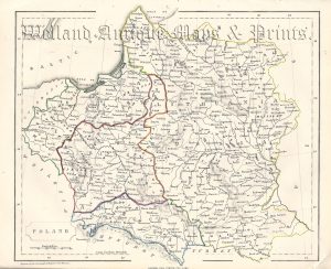
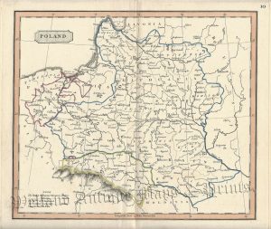
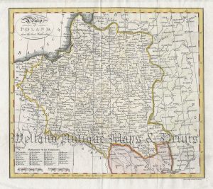
A detailed and attractive mid 19th century map of Prussia (modern day Germany / Poland / Kalingrad) which was drawn and engraved by John Dower and published in A New General Atlas of Modern Geography (London: Orr & co., c.1842).
- This is an original steel engraving with original hand colour.
- Printed area is approximately 27.4cms by 20.7cms.
- The map is in very good condition with decent margins. Click on image for a better view.
- Click on ‘Delivery Policy’ for postage costs.
- Guaranteed to be over 175 years old.