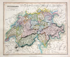
A very finely engraved, detailed and attractive mid 19th century map of Switzerland — with vignette views of Lausanne and the Chapel of William Tell — which was published in C. V. Monin & A. Vuillermin Atlas Geographe Ancienne et Moderne (Paris: Garnier Frebes, 1843).
- This is an original steel engraving with original (outline) hand colour.
- Printed area is approximately 28.3cms by 21.8cms.
- The engraving is in very good condition with decent margins. Click on image for a better view.
- Click on ‘Delivery Policy’ for postage costs.
- Guaranteed to be over 170 years old.
!['SUISSE' [Switzerland] by Jean Migeon c.1899](https://www.wellandantiquemaps.co.uk/wp-content/uploads/2023/01/Switzerland-Migeon-copy-300x226.jpg)