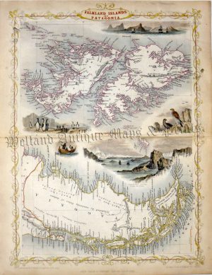
A detailed and attractive late 19th century map of the Falkland Islands which was taken from the survey by Captains Robert Fitzroy, William Robinson and Bartholomew James Sulivan of the Royal Navy and published in [Edward] Stanford’s London Atlas of Universal Geography (London: Edward Stanford, 1894).
- This is an original late 19th century chromolithograph.
- Printed area is approximately 67.1cms by 50.2cms.
- The map is in very good condition with decent margins; central fold, as issued. Click on image for a better view.
- Click on ‘Delivery Policy’ for postage costs.
- Guaranteed to be over 120 years old.