
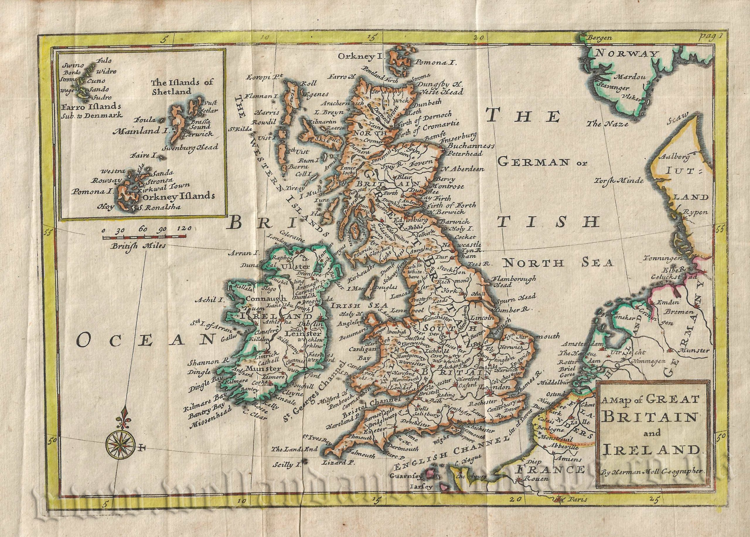
An attractive and interesting early 18th century Herman Moll map of Great Britain and Ireland which was published in Thomas Cox’s Magna Britannia et Hibernia (London: 1738).
Herman Moll (c.1654-1732), born in either Germany or the Netherlands, came to London in the 1670s where he gradually established himself as one of the leading map publishers of the day. He was particularly noted for his contempt for plagiarists describing them amongst other things as ‘ignorant pretenders’.
- This is an original copperplate engraving with later hand colour.
- Printed area is approximately 25.2cms by 17.6cms.
- The map is in very good condition; vertical folds, as issued. There is some light creasing including a ‘printer’s crease’ Click on image for better view.
- The item comes displayed in a ready to frame museum quality mount.
- Click on ‘Delivery Policy’ for Postage costs.
- Guaranteed to be over 280 years old.


