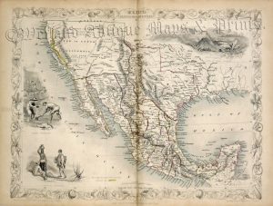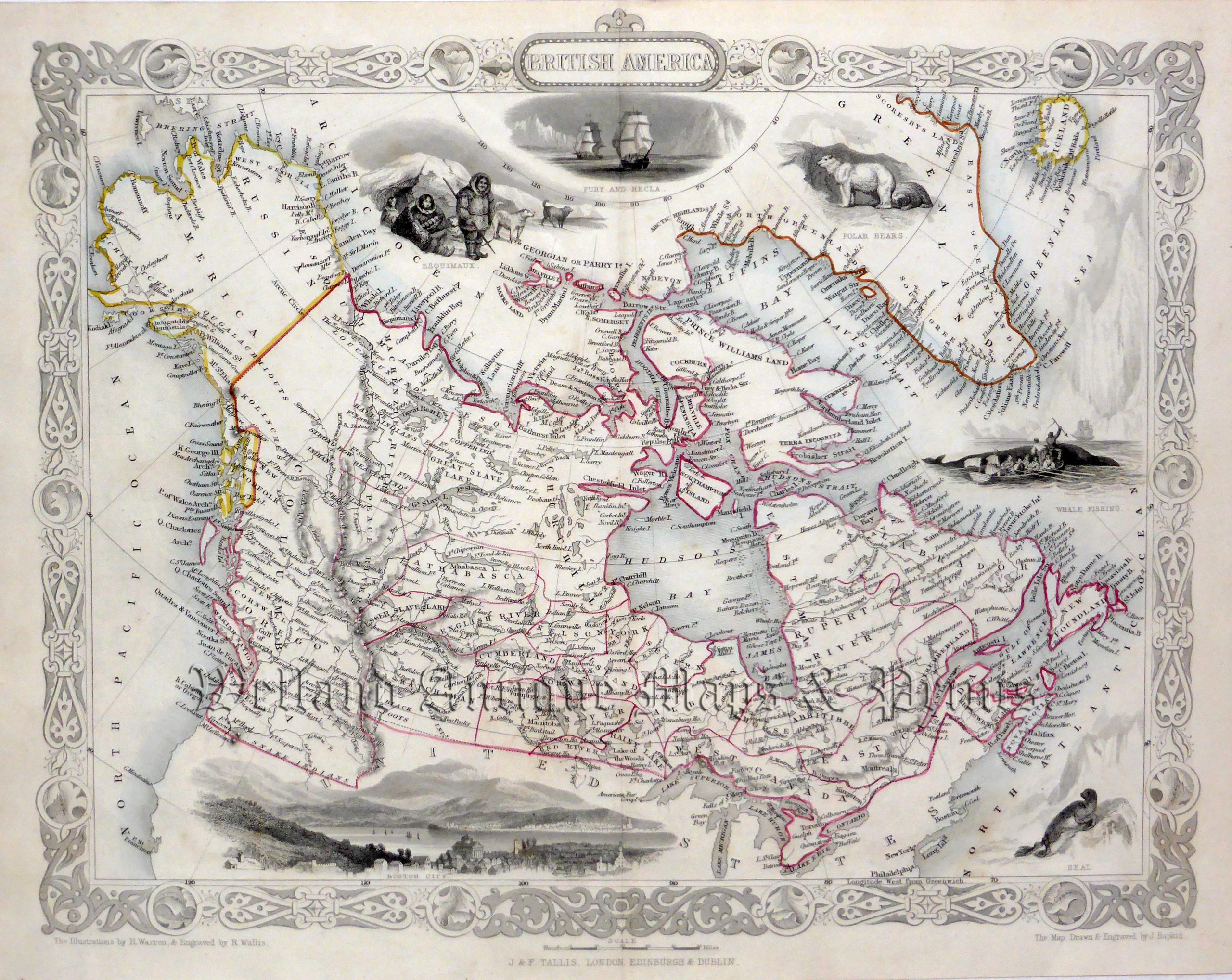
A highly decorative and detailed mid 19th century map of ‘British America’ (Canada) which was engraved by J. Rapkin (vignettes by H. Warren & R. Wallis) and published in John Tallis’s Illustrated Atlas (London, Edinburgh & Dublin: c.1851). An interesting feature of the map is that, at the time of its publication, Alaska was part of Russia i.e. ‘Russian America’.
The Illustrated Atlas, published from 1849 to 1853, was the last decorative world atlas. The ‘British America’ map was typical of the many fine ones which appeared in this work with its decorative border and attractive vignettes. Illustrated are views of the City of Boston, Fury and Hecla, ‘Esquimaux’ (Eskimoes), whale fishing, polar bears and a seal.
- This is an original steel engraving with original hand colour.
- Printed area is approximately 33cms by 26.1cms.
- The map is in very good condition with decent margins. Click on image for a better view.
- Click on ‘Delivery Policy’ for postage costs.
- Guaranteed to be over 155 years old.