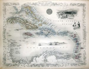
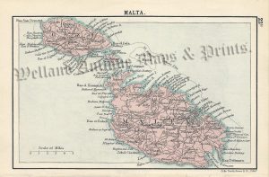
A decorative and detailed mid 19th century map of the British possessions in the Mediterranean — including Gibraltar, Malta & Gozo, Gemiler Island (St. Nicholas Island) the Ionian Islands of Corfu, Cephalonia, Ithaca, Lefkada (Santa Maura) and Zante — which was drawn and engraved by J. Rapkin (vignettes by H. Winkles) and published in John Tallis’s Illustrated Atlas (London & New York: John Tallis & co, c.1849-1853). The original page of text which accompanies the map is included.
The Illustrated Atlas, published from 1849 to 1853, was the last decorative world atlas. The ‘British Possessions in the Mediterranean’ map was typical of the many fine ones which appeared in this work with its decorative border and attractive vignettes. Illustrated are views of Gibraltar; Valetta; Corfu; Vatni, Ithaca and Greek fishing boats.
- This is an original steel engraving with original hand colour.
- Printed area is approximately 25.5cms by 35.6cms.
- The map is in very good condition with adequate margins. Click on image for a better view.
- Click on ‘Delivery Policy’ for postage costs.
- Guaranteed to be over 160 years old.