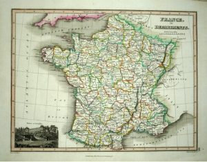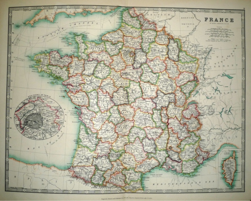
A very attractive and detailed late 19th century map of France, with an interesting oval inset plan of Paris, which was published in Alexander Keith Johnston’s Handy Royal Atlas of Modern Geography (Edinburgh & London: W. & A.K. Johnston, 1893).
- This is an original lithographic transfer / chromolithograph.
- Printed area is approximately 43cms by 33cms.
- The map is in very good condition with decent margins. There are three minor edge tears not affecting the printed area. Click on image for a better view.
- Click on ‘Delivery Policy’ for postage costs.
- Guaranteed to be over 100 years old.