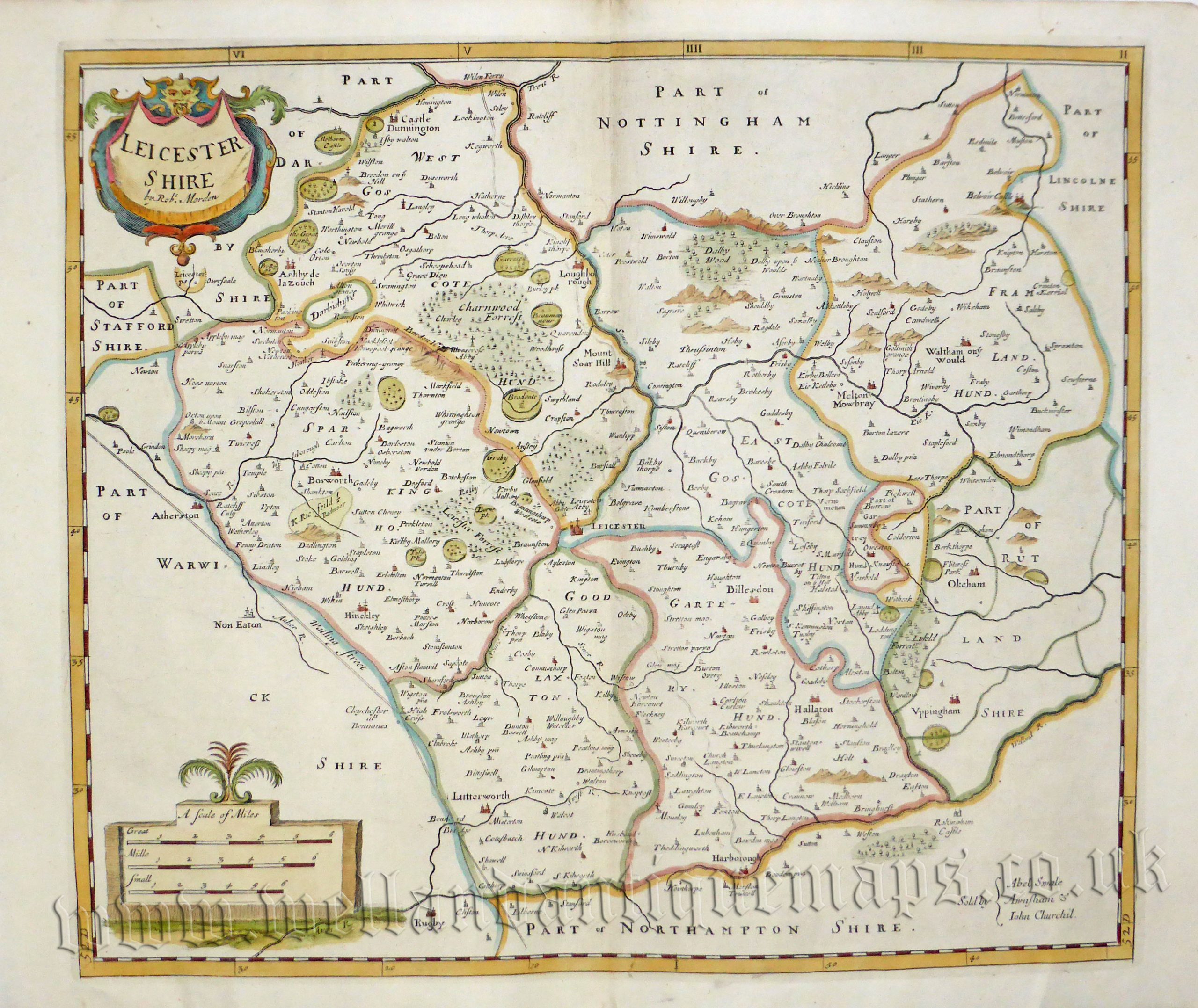
An attractive and detailed map of Leicestershire which was originally produced by Robert Morden in 1695 and published in Camden’s Britannia (London: 1695-1772). Bishop Gibson described the maps from this series as “much the fairest and most correct of any that have yet appeared”. The maps are also notable for using up to three different mileage scales, none of which are based on the statute mile!
This particular map comes from the 1722 edition as it has the distinct ‘spread eagle’ watermark. This is one of the few cases where a watermark can be used to date a map precisely.
- This is an original copperplate engraving with later hand colour.
- Printed area is approximately 41.7cms by 35.9cms.
- The map is in very good condition with decent margins. Click on image for a better view.
- Click on ‘Delivery Policy’ for postage costs.
- Guaranteed to be over 300 years old.