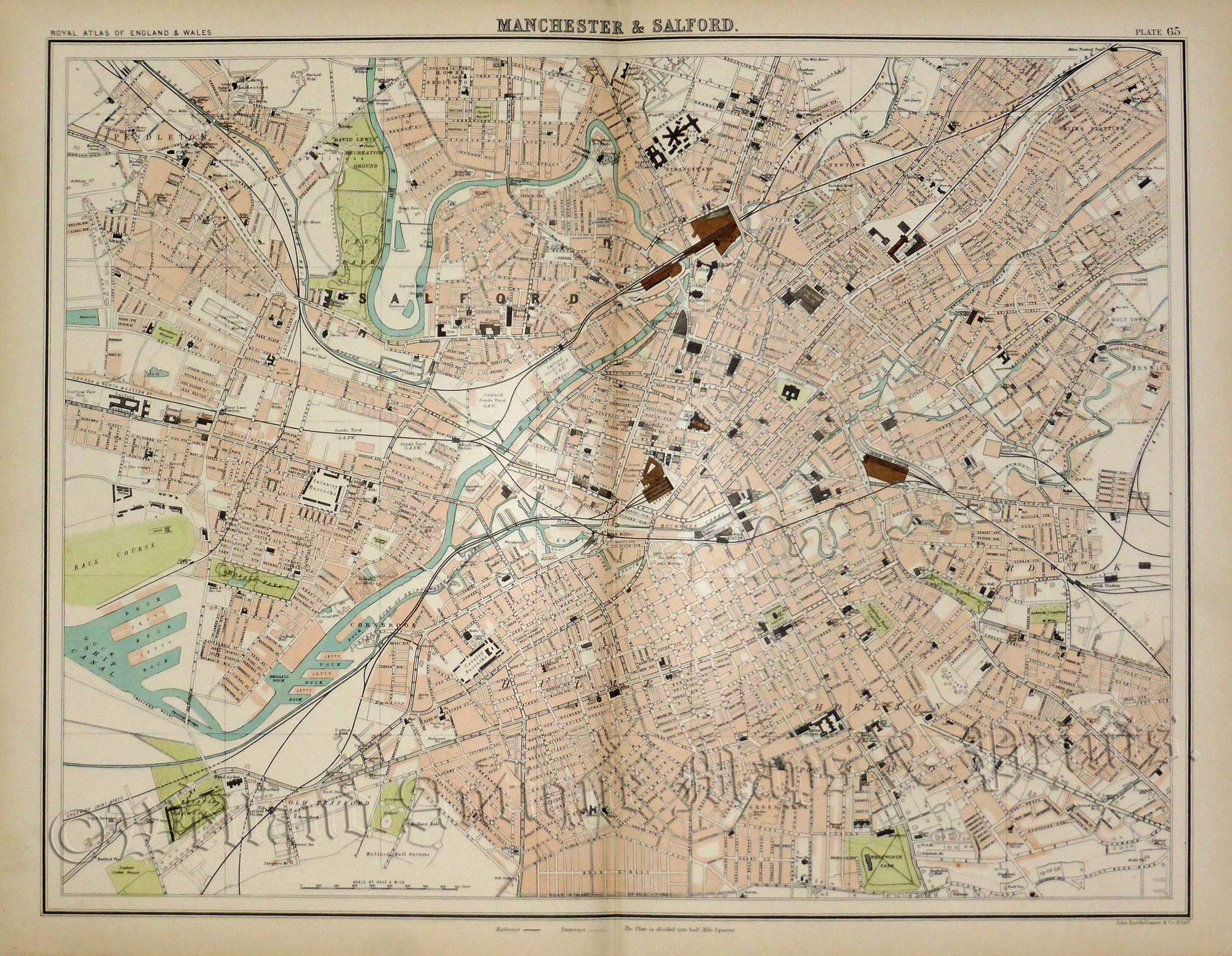
An interesting and detailed late 19th century plan of Manchester and Salford (formally Lancashire) which appeared in John Bartholomew’s Royal Atlas of England & Wales (Edinburgh: J. Bartholomew & co., 1898-1899).
- This is an original chromolithograph.
- Printed area is approximately 42.3cms by 33.6cms.
- The map is in very good condition with decent margins; centrefold, as issued. Click on image for a better view.
- Click on ‘Delivery Policy’ for postage costs.
- Guaranteed to be over 100 years old.