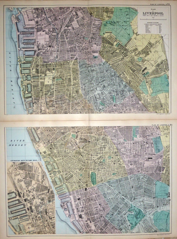
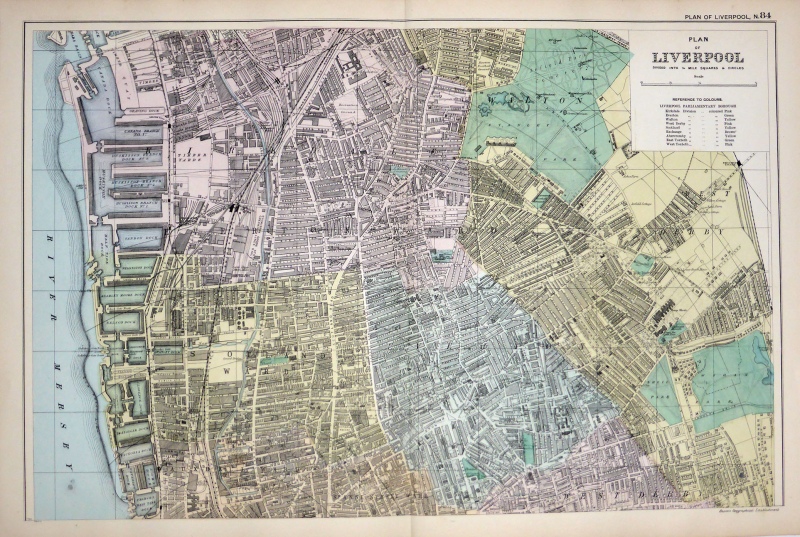
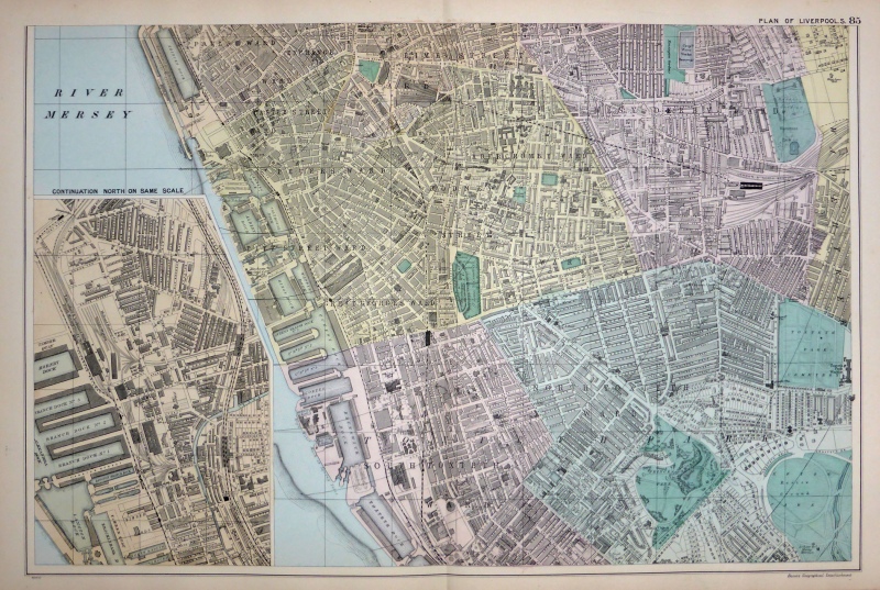
A detailed and attractive early 20th century map of Liverpool, printed on two sheets of paper and with an inset plan of the Docks, which was published in George W. Bacon’s Commercial And Library Atlas of the British Isles From The Ordnance Survey (London: G. W. Bacon & Co., 1907).
- This is an original early 20th century chromolithograph.
- Printed area is approximately 48cms by 32.1cms for sheet 84 and 48.1cms by 36.1cms for sheet 85.
- The maps are in very good condition with decent margins, centre folds as issued. Click on image for a better view.
- Click on ‘Delivery Policy’ for postage costs.
- Guaranteed to be over 100 years old.