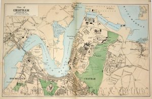
An interesting and detailed late 19th century map of the Environs of Cork which was drawn by Edward Weller F.R.G.S. and published in George W. Bacon’s New Large Scale Ordnance Atlas of the British Isles (London: G. W. Bacon & Co., 1884).
- This is an original late 19th century chromolithograph.
- Printed area is approximately 42.4cms by 31.7cms.
- The map is in very good condition with decent margins; centrefold, as issued. Click on image for a better view.
- Click on ‘Delivery Policy’ for postage costs.
- Guaranteed to be over 140 years old.

!['WARWICKSHIRE' by 'Reuben Ramble' (Rev. Samuel Clark) c.[1844?] 1845](https://www.wellandantiquemaps.co.uk/wp-content/uploads/2024/04/Warwickshire-Ramble-02-001-copy-300x374.jpg)