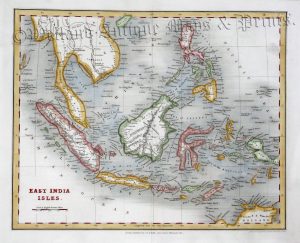
A very attractive and detailed Victorian map of Indian Archipelago (Indonesia and the Philippines) which was originally drawn and engraved by Edward Weller and published in The Comprehensive Atlas and Geography of the World (Glasgow, Edinburgh & London: Blackie & Son, 1884).
- This is an original late 19th century chromolithograph.
- Printed area is approximately 50.3cms by 35.7cms (including imprint).
- The map is in very good condition with decent margins; centrefold, as issued. Click on image for a better view.
- Click on ‘Delivery Policy’ for postage costs.
- Guaranteed to be over 130 years old.