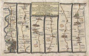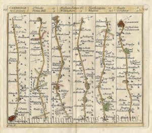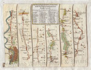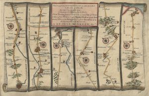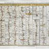
An interesting 18th Century road strip map — showiing the route from Darlaston Bridge to Carlisle via Newcastle under Lyme, Warrington, Wigan, Preston, Lancaster, Kendal and Penrith; and then the route from Carlisle to Berwick via Jedburgh and Kelso — which was drawn and engraved by J. Gibson and published in Sylvanus Urban’s The Gentleman’s Magazine (London: D. Henry, 1766).
‘The Gentleman’s Magazine’ was founded in London by Edward Cave (pen name: Sylvanus Urban) in 1731. It was the first ever periodical to use the term ‘magazine’; coming from the French / Arabic word for a ‘storehouse’. Focusing on an array of subjects including politics, the publication became very popular reaching sales of 10,000 in its first eight years and over 15,000 by the 1740s. Amongst its many contributors was Samuel Johnson who first found regular employment as a writer. ‘The Gentleman’s Magazine’ remained popular throughout the 18th and 19th centuries but by the early 20th century it sales had dropped to the extent that it was finally discontinued in 1922.
- This is an original copperplate engraving with later hand colour.
- Printed area is approximately 28.7cms by 18.5cms.
- The map is in very good condition with decent margins. A small hole in the tenth strip has been repaired. Click on image for a better view.
- The item comes displayed in a ready to frame museum quality mount.
- Click on ‘Delivery Policy’ for postage costs.
- Guaranteed to be over 250 years old.