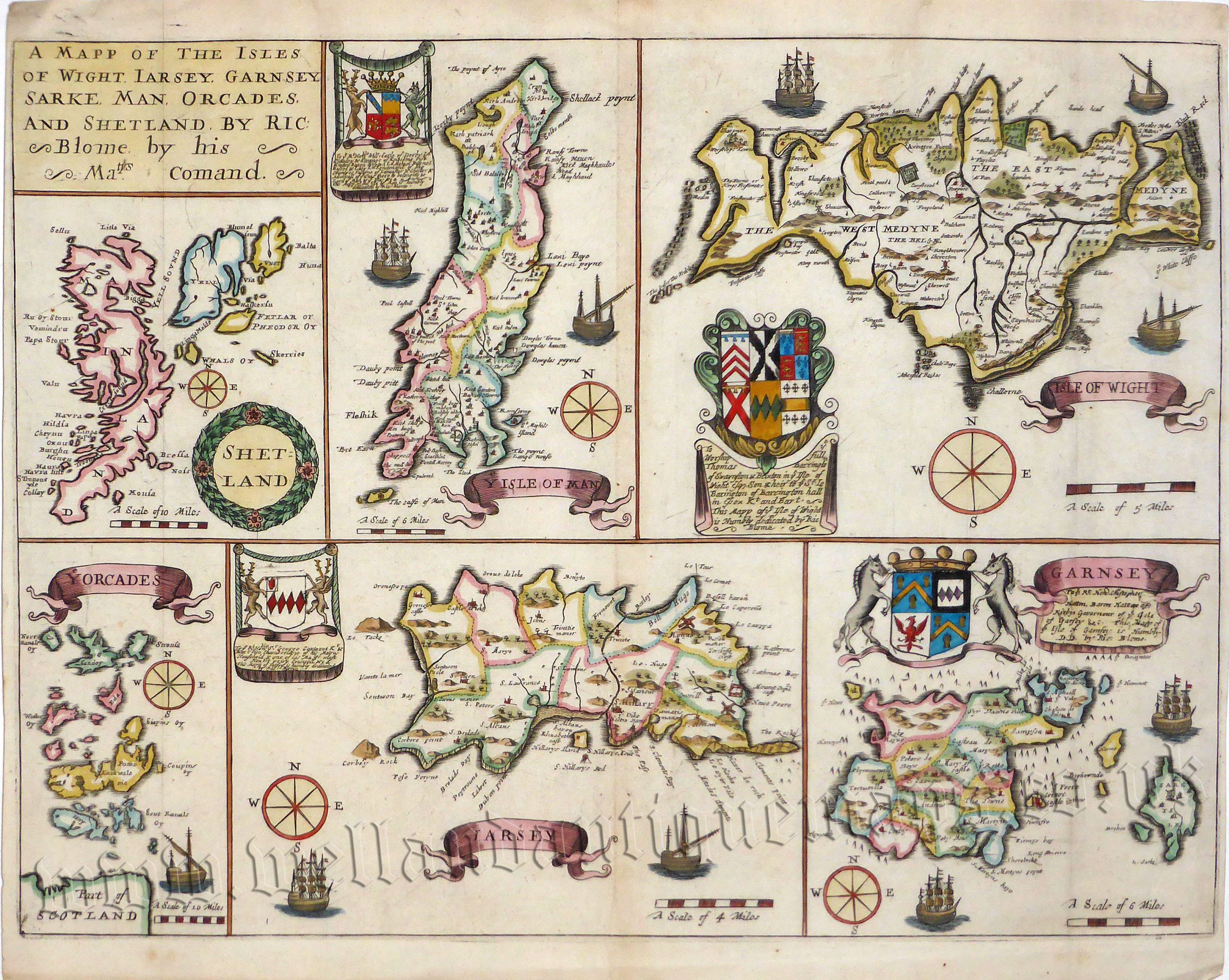
A very attractive and uncommon 17th Century map of the British Islands including the The Shetlands and Orkneys, The Isle of Man, The Isle of Wight, Jersey and Guernsey which was published in Richard Blome’s Britannia (London: 1673).
Richard Blome (1635-1705) was a noted heraldic writer, cartographer and publisher who flourished in the latter half of the 17th century. He was a prolific, if not always original, worker and was thus frequently accused of plagiarism by his contemporaries. In Blome’s defence, he usually cited his sources and, as with all map publishers of the period, did not have the resources to improve on the existing cartographic information available; nevertheless, his maps were attractive and quaintly designed and have retained a certain charm to this day.
His first series of county maps, the ‘Britannia’, based on the latest Speed maps, was published in 1673 but this was not a success (hence their relative rarity). This was followed in 1681 with smaller ones entitled “Speed’s Maps Epitomiz’d”. In both cases, many of these maps were engraved by Robert Palmer, Francis Lamb and most notably, the renowned Wenceslaus Hollar (1607-1677).
-
This is an original copperplate engraving with later hand colour.
-
Printed area is approximately 36.9cms by 27.5cms.
-
The map is in very good condition; centrefold, as issued. The left and right margins are close, as issued. Click on image for a better view.
-
Click on ‘Delivery Policy’ for postage costs.
-
Guaranteed to be over 300 years old.