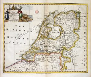
A very attractive and neatly engraved mid 18th century map — with a highly decorative cartouche and sea chart of the North Sea — of the United Provinces (The Netherlands) which was engraved by Emanuel Bowen and published in his A Complete System of Geography (London: 1747).
Emanuel Bowen (fl. 1714-1767) was among the most renowned and prolific map engravers of the 18th century. Along with Thomas Kitchin and his son, Thomas Bowen, he produced some of the finest maps and atlases of the period. His recognition was such that he was appointed Geographer to both George II of Great Britain and Louis XV of France. Despite his many achievements, however, he never enjoyed lasting financial success and died in great poverty.
- This is an original copperplate engraving with later hand colour.
- Printed area is approximately 22cms by 31.5cms.
- The map is in very good condition. The left margin is close but still mountable. Click on image for a better view.
- Click on ‘Delivery Policy’ for postage costs.
- Guaranteed to be over 250 years old.
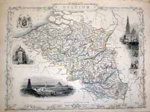
!['THE NETHERLANDS including LIEGE' [Belgium & Luxembourg] by Robert Wilkinson c.1809](https://www.wellandantiquemaps.co.uk/wp-content/uploads/2023/01/Netherlands-Wilkinson-01-copy-300x237.jpg)