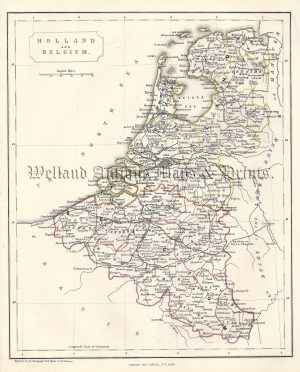
A very attractive late 19th century map of Belgium and Netherlands (with Luxembourg) by J. Bartholomew F.R.G.S.
- This is an original chromolithograph (lithographic transfer).
- Printed area is approximately 42cms by 55.5cms
- The map is in very good condition with decent margins There is a loss of paper to the left centrefold not affecting the printed area. Click on image for a better view.
- Click on Delivery Policy for postage costs.
- Guaranteed to be over 100 years old.