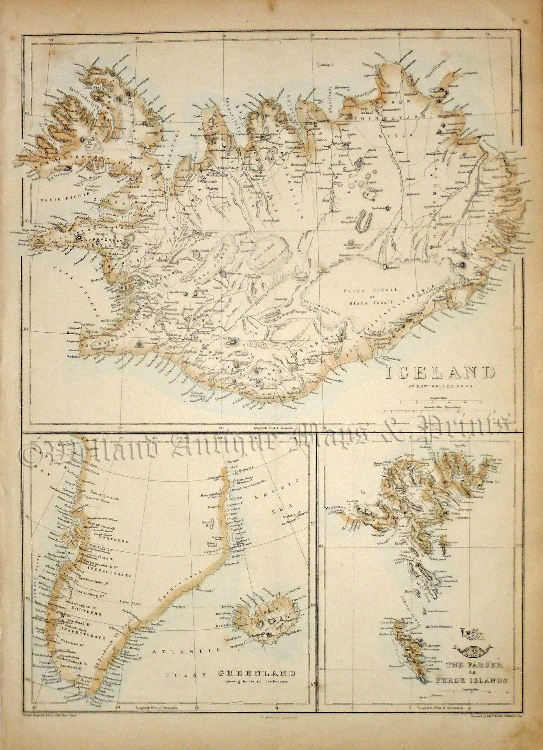
An interesting and detailed 19th century map of Iceland, Greenland and the Faroe Islands which was drawn / lithographed by Edward Weller F. R. G. S. and published in Cassell’s Complete Atlas / Weekly Dispatch Atlas (London: Cassell, Peter & Galpin, 1866).
- This is an original lithographic transfer with original hand colour.
- Printed area is approximately 31.3cms by 42.9cms.
- The item is in very good condition with decent margins, vertical crease running down the centre, as issued. Click on image for a better view.
- Click on ‘Delivery Policy’ for postage costs.
- Guaranteed to be over 150 years old.