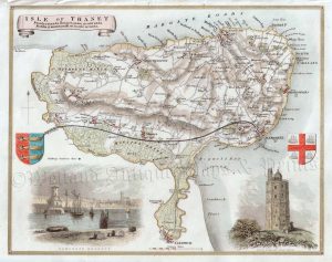
An interesting, detailed and attractive map of Kent, first produced by Robert Morden in 1695, which appeared in Camden’s Britannia (London: Swale, Awnshaw & Churchill, 1695 – 1772). Bishop Gibson described the maps from this series as “much the fairest and most correct of any that have yet appeared”. The maps are also notable for using up to three different mileage scales, none of which are based on the statute mile!
- This is an original copperplate engraving with later hand colour.
- Printed area is approximately 62.8cms by 34.7cms.
- The map is in very good condition with decent margins; vertical folds, as issued. There is a small repair in the bottom margin not affecting the printed area. Click on image for a better view.
- Click on ‘Delivery Policy’ for postage costs.
- Guaranteed to be at least 250 years old. .
!['KENT' by 'Reuben Ramble' (Rev. Samuel Clark) c.[1844?] 1845](https://www.wellandantiquemaps.co.uk/wp-content/uploads/2023/01/Kent-Ramble-001-copy-300x245.jpg)