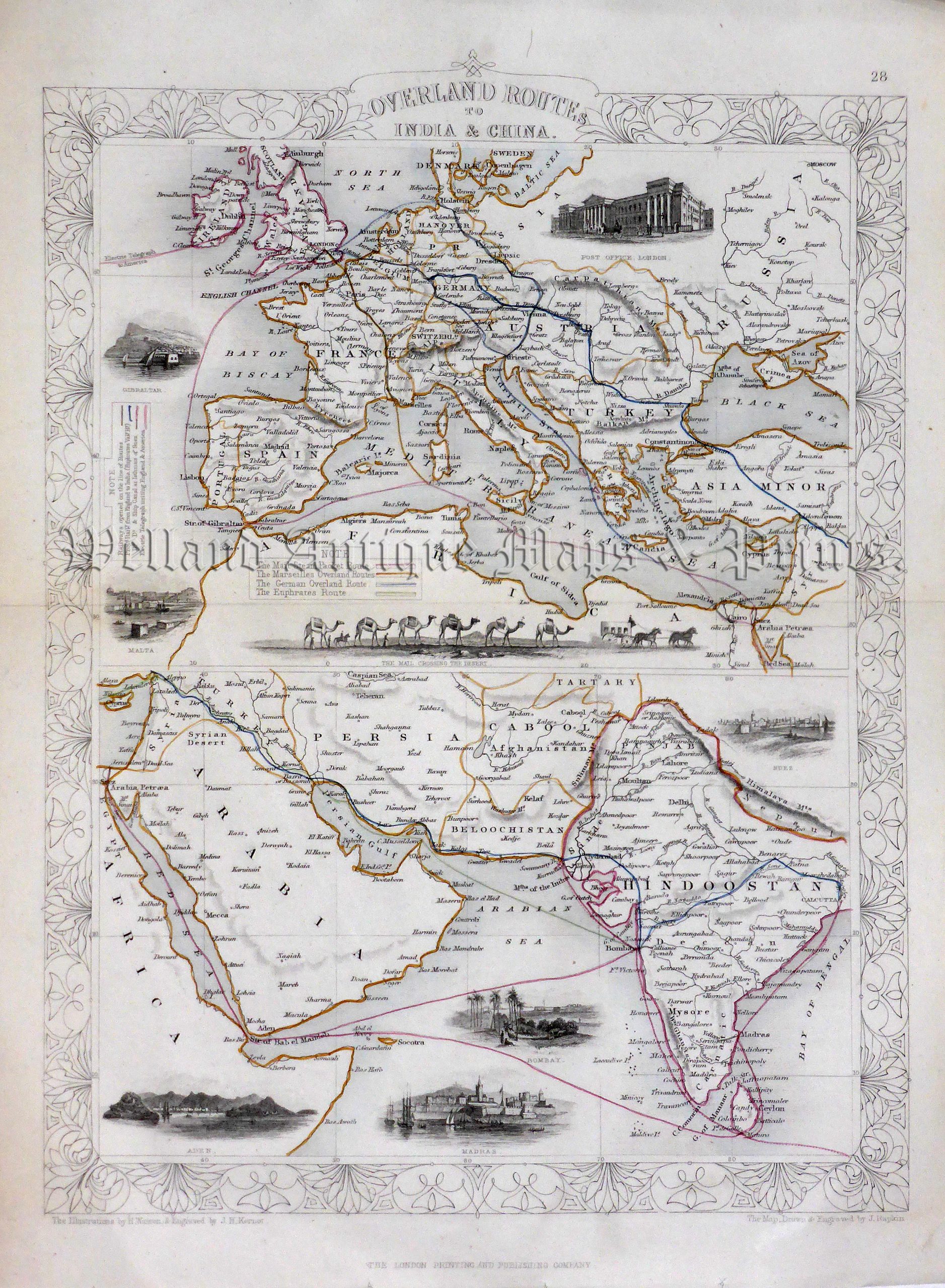
A highly decorative and detailed mid 19th century double map showing the mail route from Britain to India which was drawn and engraved by J. Rapkin (vignettes by H. Warren & J. H. Kernot) and published in John Tallis’s Illustrated Atlas (London & New York: John Tallis & co, c.1853).
The Illustrated Atlas, published from 1849, was the last decorative world atlas. The map of the ‘Overland Routes to India & China’ was typical of the many fine ones which appeared in this work with its decorative border and attractive vignettes. Illustrated are views of the Post Office, London; Gibraltar; Malta; the mail crossing the desert by Camel train; Suez; Aden; Bombay (Mumbai) and Madras.
- This is an original steel engraving with original hand colour.
- Printed area is approximately 24.6cms by 33.1cms (not including imprint.
- The map is in very good condition with adequate margins; centrefolded, as issued. Click on image for a better view.
- Click on ‘Delivery Policy’ for postage costs.
- Guaranteed to be over 155 years old.