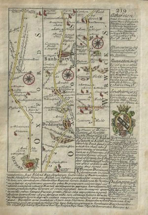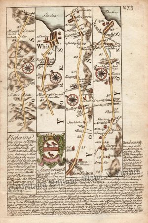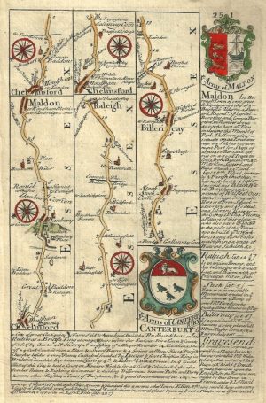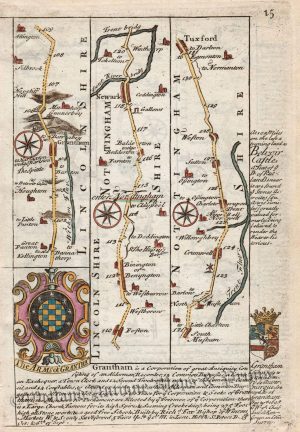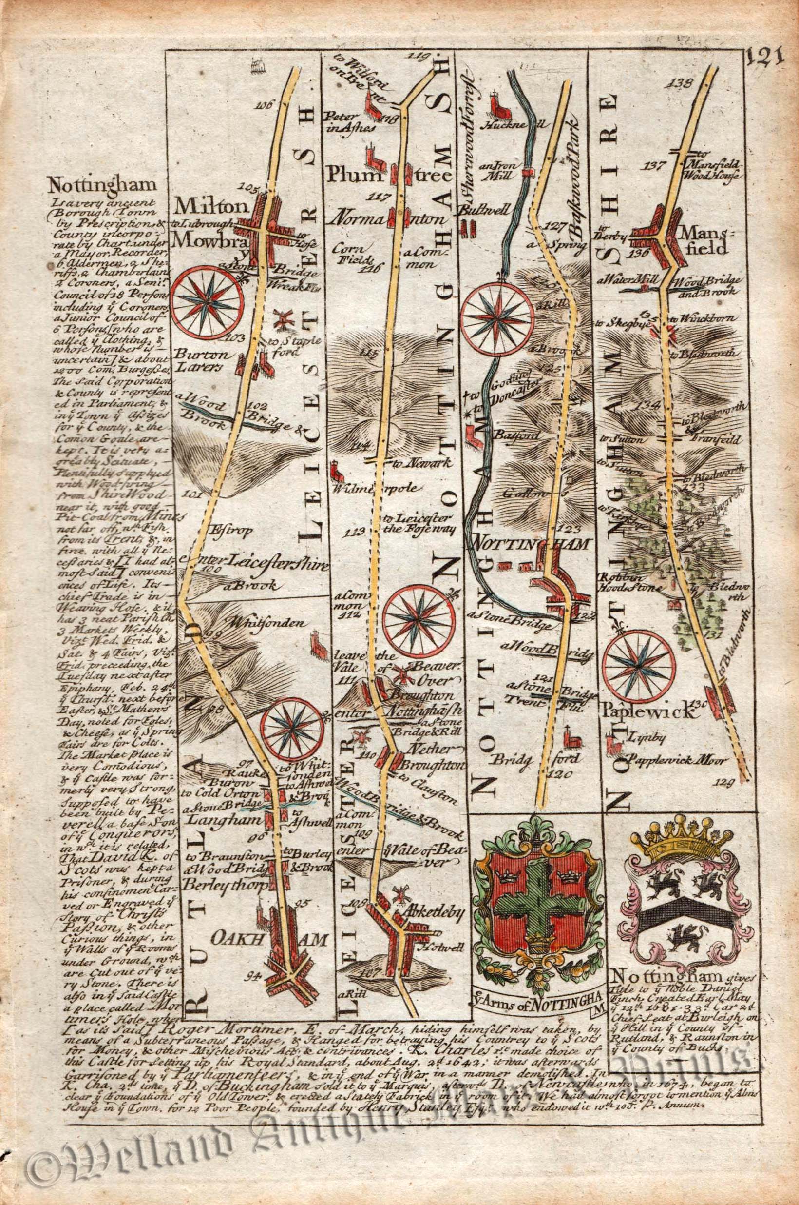
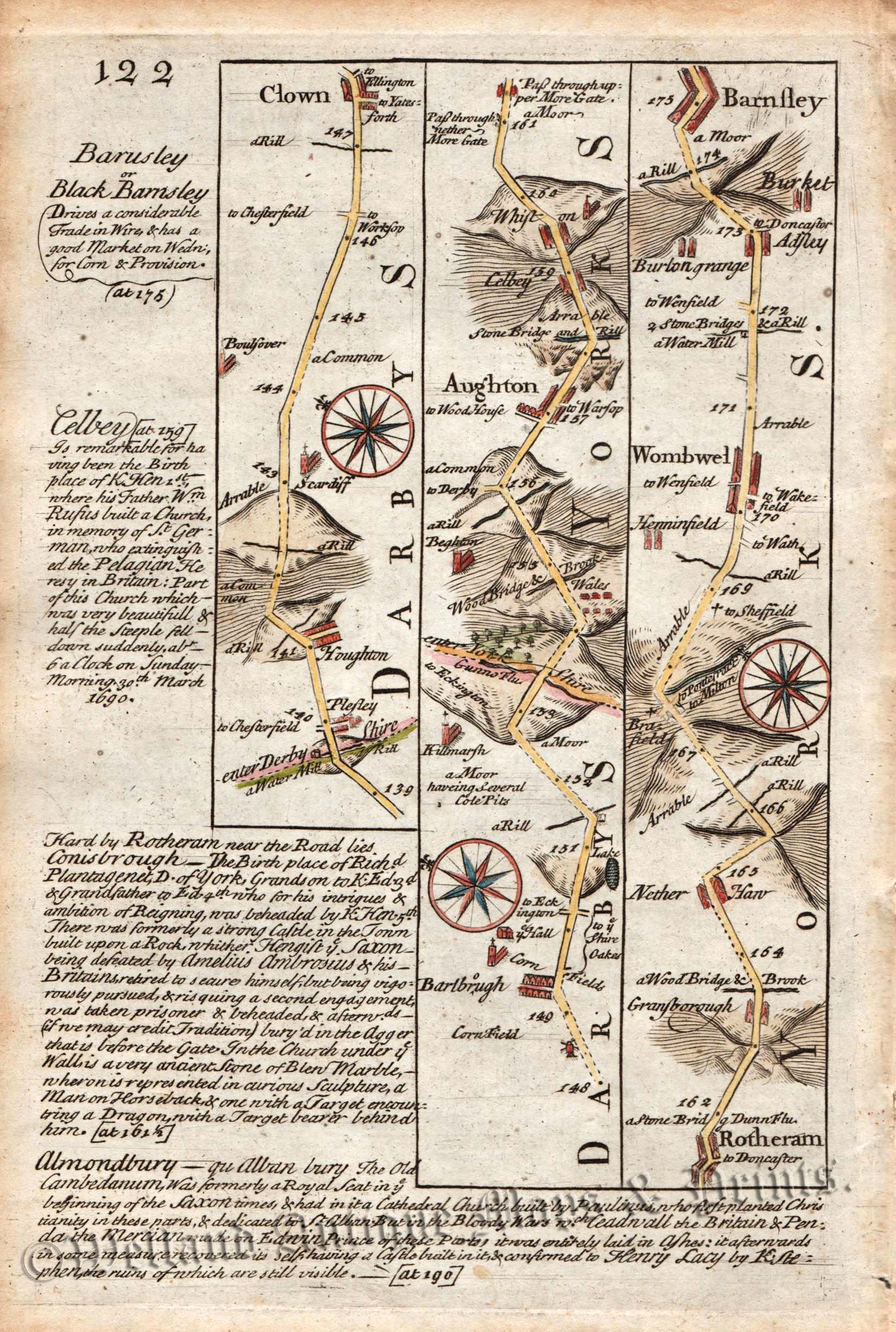
A charming 18th century road strip map showing the route from Oakham to Barnsley — via Melton Mowbray, Ab Kettleby, Nether Broughton, Plumtree, Nottingham, Papplewick, Mansfield, Clowne and Rotherham — which appeared in John Owen & Emanuel Bowen’s Britannia Depicta or Ogilby Improv’d (London: T. Bowles, 1720-1764).
The Owen and Bowen road strip maps were based on the far larger ones done by John Ogilby in the 1670s. Their smaller format of ½ inch to the mile, however, made them far more practical and portable than the folio sized Ogilby road atlas which weighed 4½ pounds! Each map was finely engraved by Emanuel Bowen, who was one of the most renowned and prolific map makers of the 18th century. The maps also had the added feature of copius amounts of information, written by John Owen, describing the places visited.‘Britannia Depicta’ proved to be immensely popular with the travelling public and was continually published for nearly 50 years.
- This is an original copperplate engraving with later hand colour.
- Printed areas are approximately 11.6cms by 17.6cms for page 121 and 11.5cms and 17.8cms for page 122.
- The map is in very good condition with decent margins. Click on image for better view.
- The item comes displayed in a ready to frame museum quality mount.
- Click on ‘Delivery Policy’ for Postage costs.
- Guaranteed to be over 250 years old.