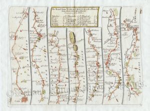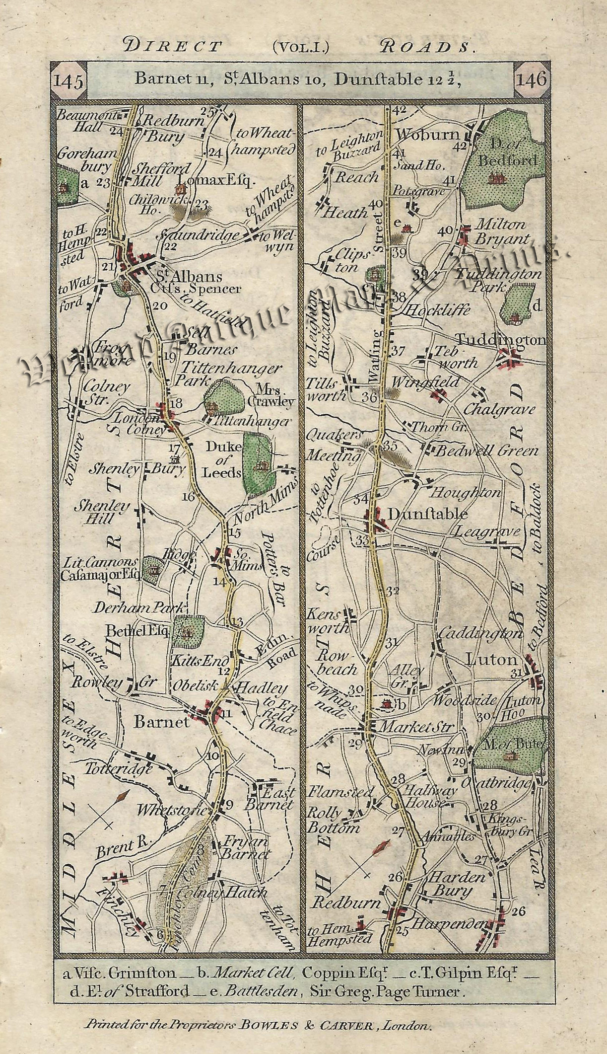
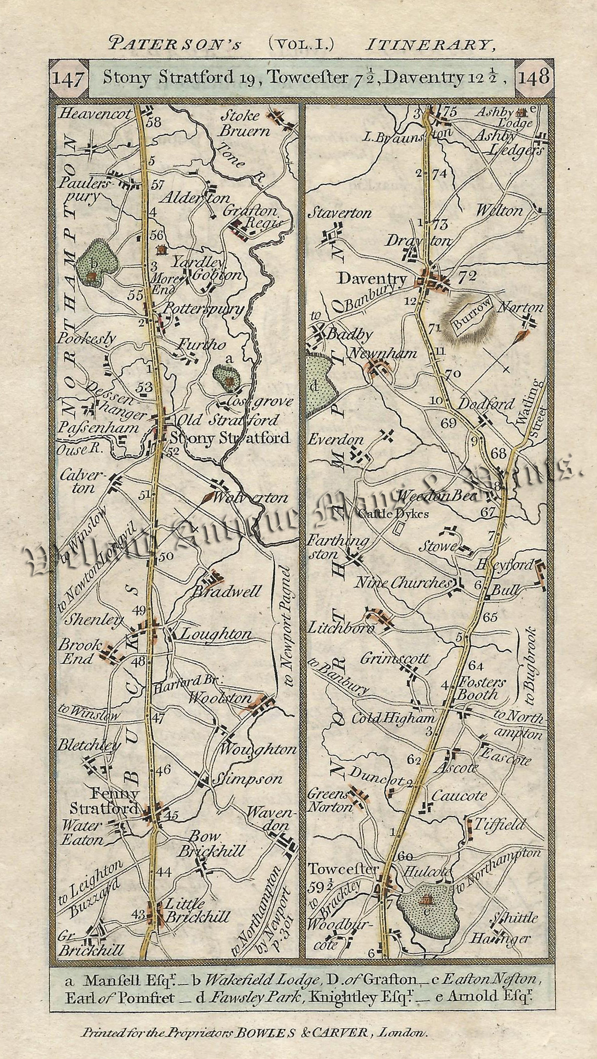
An interesting, double sided, late 18th century road strip map — showing the route from Barnet (Hertfordshire) to Daventry (Northamptonshire) — via St. Alban’s, Dunstable, Stony Stratford and Towcester — which appeared in Paterson’s British Itinerary (London: Bowles & Carver, 1785).
- This is an original copperplate engraving with later hand colour.
- Printed areas are approximately 8.8cms by 17.3cms for both strip 145/146 and 147/148 (including imprints).
- The map is in very good condition with decent margins. Click on image for a better view.
- The item comes displayed in a ready to frame acid free mount.
- Click on ‘Delivery Policy’ for postage costs.
- Guaranteed to be over 200 years old.