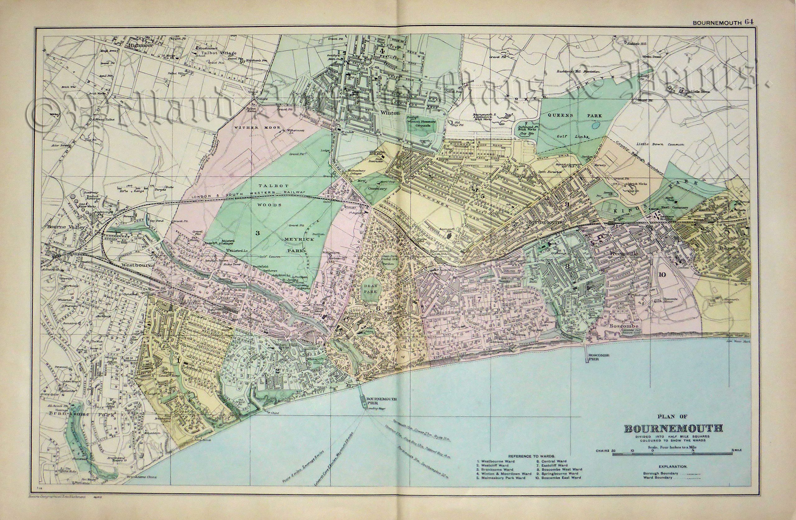
A detailed and attractive early 20th century plan of Bournemouth, Hampshire which was published in George W. Bacon’s Commercial And Library Atlas of the British Isles From The Ordnance Survey (London: G. W. Bacon & Co., 1912).
- This is an original early 20th century chromolithograph.
- Printed area is approximately 47.2cms by 31.4cms.
- The map is in very good condition with decent margins; centrefold, as issued. Click on image for a better view.
- Click on ‘Delivery Policy’ for postage costs.
- Guaranteed to be over 110 years old.
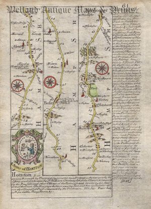
![Plate 81: The Road from OXFORD to CHICHESTER [via Abingdon, Newbury, Basingstoke] By John Ogilby c.1675 (First Edition)](https://www.wellandantiquemaps.co.uk/wp-content/uploads/2023/01/P1080562-copy-300x242.jpg)