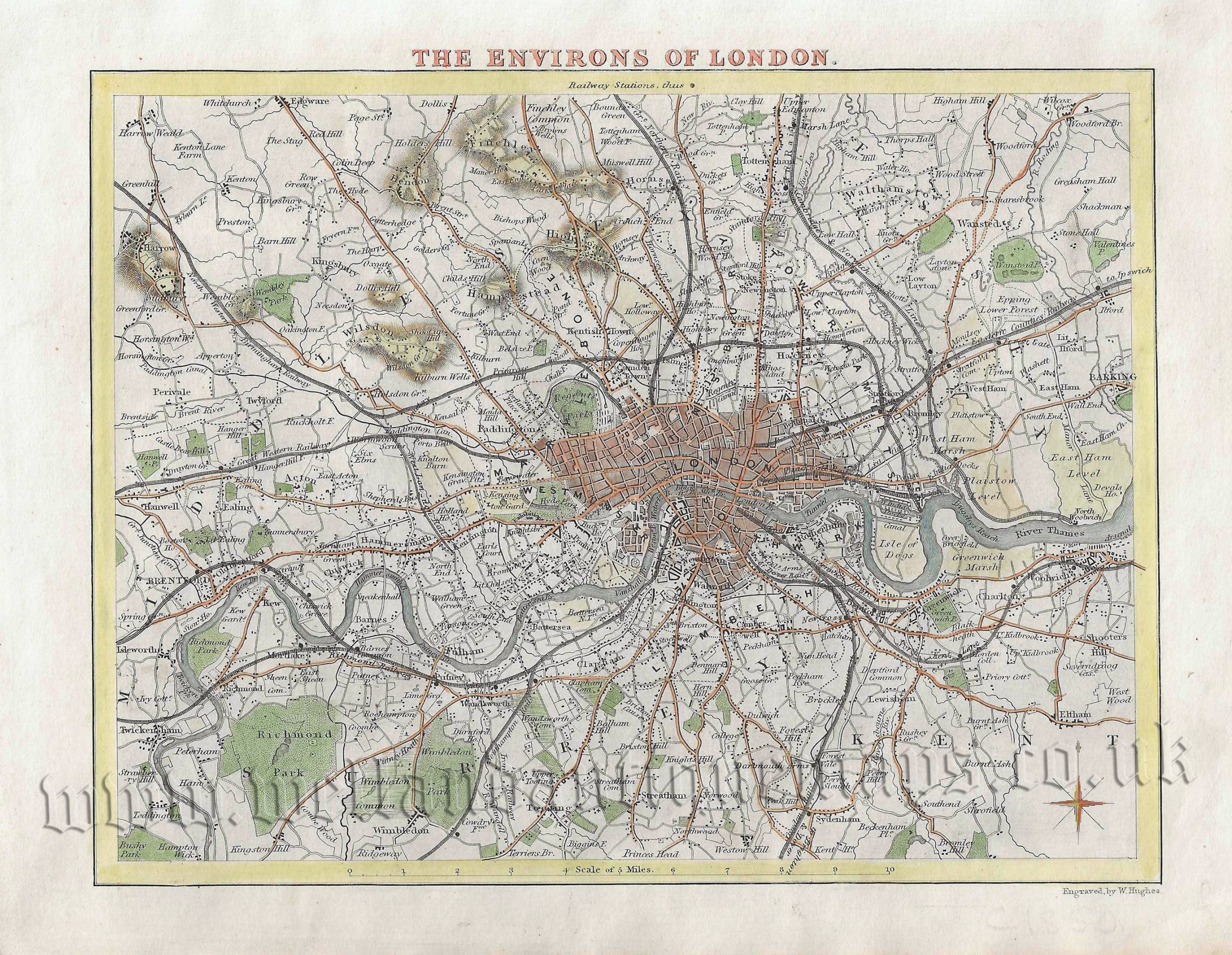
An attractive and detailed 19th century Thomas Moule map of the Environs of London which was engraved by W. Hughes and published in Barclay’s Complete & Universal English Dictionary. (London: G. Virtue, 1840s). An interesting feature of the map is the depiction of the early railway lines.
By the mid 19th century, London was the largest city in the world with a population of approximately 2 million inhabitants. This was still small by today’s comparison as places such as Tottenham, Highgate, West Ham, Fulham, Tooting and Woolwich were still separate settlements at some distance from the capital. In the decades after this map was produced London was to grow at an unprecedented level into the city we know today.
- This is an original steel engraving with later hand colour.
- Printed area is approximately 21.4cms by 16.8cms.
- The map is in very good condition with decent margins. Click on image for a better view.
- The item comes displayed in a ready to frame museum quality mount.
- Click on ‘Delivery Policy’ for postage costs.
- Guaranteed to be over 160 years old.