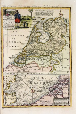
!['THE NETHERLANDS including LIEGE' [Belgium & Luxembourg] by Robert Wilkinson c.1809](https://www.wellandantiquemaps.co.uk/wp-content/uploads/2023/01/Netherlands-Wilkinson-01-copy-scaled.jpg)
An attractive and detailed early 19th century map of modern day Belgium and Luxembourg which was engraved by Froggett and published in Robert Wilkinson’s A General Atlas, being a Collection of Maps of the World and Quarters (London: 1809);
- This is an original copperplate engraving with original hand colour.
- Printed area is approximately 29.3cms by 22.2cms.
- The map is in very good condition with decent margins. Click on image for a better view.
- Click on ‘Delivery Policy’ for postage costs.
- Guaranteed to be over 200 years old.