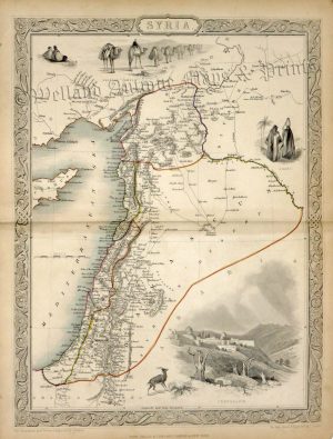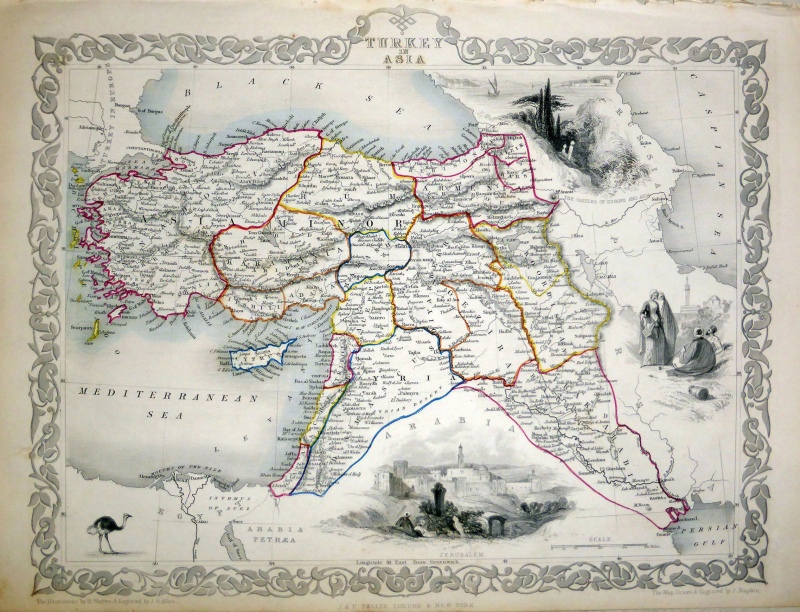
A highly decorative and finely engraved mid 19th century map of ‘Turkey in Asia’ (Middle Eastern part of the Ottoman Empire) which was engraved by J. Rapkin (vignettes by H. Warren & J. B. Allen) and published in John Tallis & co.’s The Illustrated Atlas (London & New York: c.1851)
The Illustrated Atlas, published from 1849 to 1853, was the last decorative world atlas. The ‘Turkey in Asia’ map was typical of the many fine ones which appeared in this work with its decorative border and attractive vignettes. Illustrated are views of Jerusalem, ‘The Castles of Europe and Asia’, Turkish or Persian people and an ostrich.
- This is an original steel engraving with original hand colour.
- Printed area is approximately 32.9cms by 26.2cms.
- The map is in very good condition with adequate margins. Click on image for a better view.
- Click on ‘Delivery Policy’ for postage costs.
- Guaranteed to be over 160 years old.