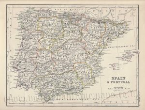
A detailed and attractive late 19th century map of Portugal and Spain — with an interesting inset plan of Gibraltar — which was originally engraved by Sydney hall and published in Black’s General Atlas (Edinburgh: A. & C. Black, 1873).
- This is an original chromolithograph (lithographic transfer from a steel plate).
- Printed area is approximately 51cms by 38.5cms.
- The map is in very good condition with decent margins. Click on image for a better view.
- Click on ‘Delivery Policy’ for postage costs.
- Guaranteed to be over 140 years old.