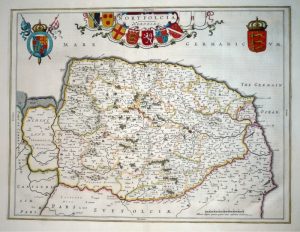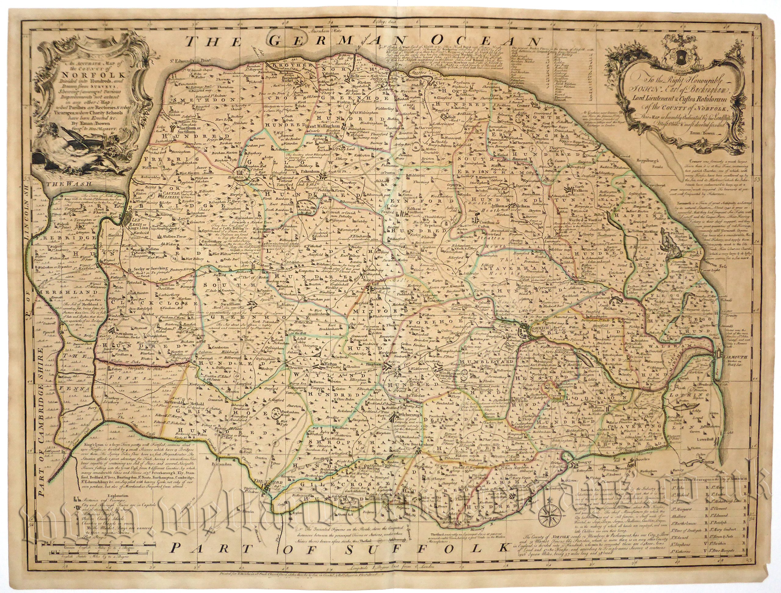
Full Title: An ACCURATE MAP of the COUNTY of NORFOLK DIVIDED into HUNDREDS, and Drawn from SURVEYS. Shewing (amongst Various Improvements not extant in any other Map) what Parishes are Rectories & what Vicarages; where Charity Schools have been Erected &c. By Eman: Bowen Geog.r to HIS MAJESTY.’
An attractive, detailed and finely engraved 18th Century map of Norfolk which was published in Emanuel Bowen and Thomas Kitchin’s Large English Atlas (London: John Hinton, 1764).
Emanuel Bowen (fl. 1714-1767) map and print seller, was engraver to George II and to Louis XV of France and worked in London from about 1714 onwards producing some of the best and most attractive maps of the century. He had plans for completing a major County Atlas but, finding the task beyond his means, joined with Thomas Kitchin to publish The ‘Large English Atlas’. Many of the maps were issued individually from 1749 onwards and the whole atlas was not finally completed until 1760. With one or two exceptions, they were the largest maps of the counties to appear up to that time and are unusual in that the blank areas around each map are filled with historical and topographical detail which makes fascinating and amusing reading. The atlas was re-issued later in reduced form… In spite of his royal appointments and apparent prosperity [Emanuel] died in poverty and his son [Thomas], who carried on the business, was no more fortunate and died in a Clerkenwell workhouse in 1790. (Moreland & Bannister, 1983, ‘Antique Maps’, p,166).
Thomas Kitchin (1718-1784) Working at premises at The Star in London’s Holborn as an engraver and publisher, Kitchin produced a very wide range of books on many subjects as well as topographical work. For many years he worked in conjunction with Emanuel Bowen and Thomas Jefferys and apart from the atlases he published with them, he produced maps of every sort for magazines and books on history and the antiquities. (Moreland & Bannister, 1983, ‘Antique Maps’, p,179).
- This is an original copperplate engraving with original hand colour.
- Printed area is approximately 68.8cms by 52cms.
- The map is in very good condition with decent margins; centrefold, as issued. There is some some age toning. Click on image for a better view.
- Click on ‘Delivery Policy’ for postage costs.
- Guaranteed to be over 250 years old.