Skip to content
Register
Login
Home
About Us
Contact Us
Feedback
Recent Additions
Shop Online
Login
Register
£
60.00
Main Menu
Our Range
Antique Maps
County Maps
Foreign Maps
Africa: Continental & Regional
Asia & The Middle East
Australasia & The Pacific
Europe: Continent & Countries
Austria, Hungary, Czech Rep. (Bohemia) & Slovakia
Belgium, The Netherlands & Luxembourg
European Continent & Misc.
France
Germany (Prussia)
Greece & The Balkans
Italy
Mediterranean Basin & Islands
Poland & The Baltic
Russia (Europe & Asia)
Scandinavia
Spain & Portugal (And Dependent Islands)
Switzerland
Maps of the World & Misc
The Americas & Caribbean
Great Britain & Ireland with Regional Maps
Renowned Map Makers
Road Maps
Title Pages / Frontispieces
Town Plans
Fairy Range
Other Prints
Topography
Home
/
Antique Maps
/
Foreign Maps
/
Europe: Continent & Countries
/ European Continent & Misc.
European Continent & Misc.
Original Antique Maps of the Continent of Europe.
View basket
“‘HAUTEUR AU DESSUS DE LA MER, DES POINTS LES PLUS ELEVES DES PRINCIPLES CHAINES DE MONTAGNES.’ by J. G. Barbie du Bocage c.1852” has been added to your basket.
‘A New and Accurate MAP of EUROPE from the latest Improvements and Regulated by Astronomical Observations.’ by T. Bowen c.1768
£
85.00
Add to basket
Add to Wishlist
Add to Wishlist
‘A NEW MAPPE OF THE ROMANE EMPIRE newly described by John Speede ..’ c.1676
£
1,250.00
Add to basket
Add to Wishlist
Add to Wishlist
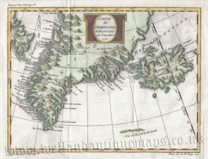
‘CARTE du GROENLAND’ (Greenland, Iceland & ‘Frisland’) by J. N. Bellin c.1770 / 1780
£
110.00
Add to basket
Add to Wishlist
Add to Wishlist
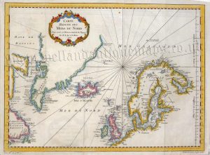
‘CARTE REDUITE DES MERS DU NORD’ (North Atlantic / North Sea) by Jacques Nicolas Bellin c.1780
£
225.00
Add to basket
Add to Wishlist
Add to Wishlist
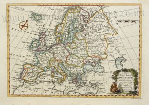
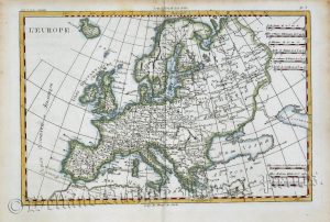
‘EUROPE from the best Authorities By T. Kitchin Geog.r’ c.1759
£
65.00
Add to basket
Add to Wishlist
Add to Wishlist
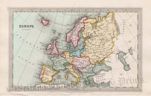
‘EUROPE’ by T. Starling c.1830
£
36.00
Add to basket
Add to Wishlist
Add to Wishlist
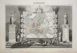
‘EUROPE’ by Victor Levasseur c.1846
£
120.00
Add to basket
Add to Wishlist
Add to Wishlist
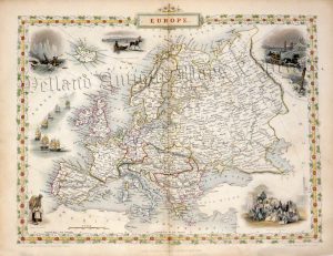
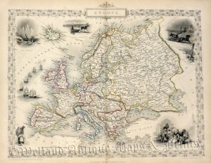
‘EUROPE.’ by John Tallis c.1853
£
135.00
Add to basket
Add to Wishlist
Add to Wishlist
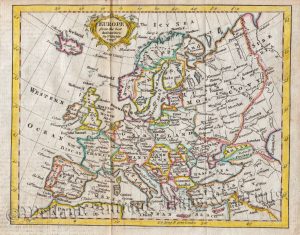
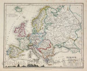
‘EUROPE.’ by John Dower c.1850
£
45.00
Add to basket
Add to Wishlist
Add to Wishlist
‘EUROPE.’ by John Tallis c.1851
£
120.00
Add to basket
Add to Wishlist
Add to Wishlist
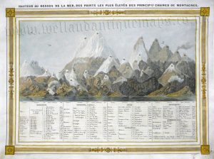
‘HAUTEUR AU DESSUS DE LA MER, DES POINTS LES PLUS ELEVES DES PRINCIPLES CHAINES DE MONTAGNES.’ by J. G. Barbie du Bocage c.1852
£
60.00
Add to basket
Add to Wishlist
Add to Wishlist
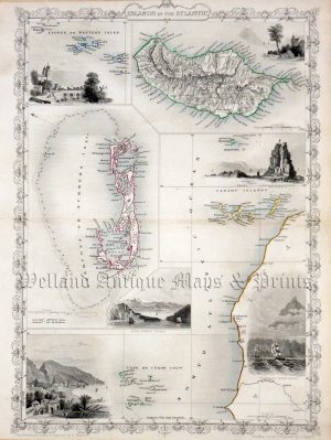
‘ISLANDS IN THE ATLANTIC’ (Azores, Madeira, Bermuda, Canary Is., Cape Verde Is.) by John Tallis c.1853
£
100.00
Add to basket
Add to Wishlist
Add to Wishlist
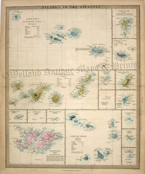
‘ISLANDS IN THE ATLANTIC’ by J. & C. Walker / S.D.U.K. c.1857
£
75.00
Add to basket
Add to Wishlist
Add to Wishlist
‘L’EUROPE’ by R. Bonne c.1783
£
65.00
Add to basket
Add to Wishlist
Add to Wishlist
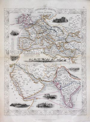
‘OVERLAND ROUTES TO INDIA & CHINA.’ by John Tallis c.1853
£
130.00
Add to basket
Add to Wishlist
Add to Wishlist
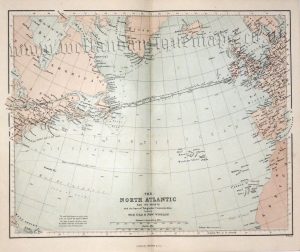
‘THE NORTH ATLANTIC AND ITS COASTS’ (Telegraphic Communication) by W. Hughes c.1868
£
20.00
Add to basket
Add to Wishlist
Add to Wishlist
Home
About Us
Contact Us
Feedback
Recent Additions
Shop Online
Login
Register
Shopping Basket
Scroll to Top