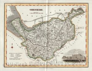
An attractive and detailed mid 19th century map of Cheshire which appeared in Thomas Dugdale’s Curiosities of Great Britain. England and Wales Delineated (London: L. Tallis, 1842). An interesting feature with maps of this period is the depiction of the then newly constructed (or proposed) railways.
- This is an original steel engraving with later hand colour.
- Printed area is approximately 23.7cms by 18.6cms (including imprint).
- The map is in very good condition with decent margins. Click on image for a better view.
- The item comes displayed in a ready to frame acid free mount.
- Click on ‘Delivery Policy’ for postage costs.
- Guaranteed to be over 165 years old.
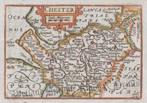
!['CESTRIAE [Cheshire] Comitatus...' (on good paper) by Saxton / Hole c.1637](https://www.wellandantiquemaps.co.uk/wp-content/uploads/2023/01/Cheshire-Saxton-Hole-02-copy-300x249.jpg)