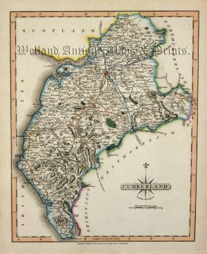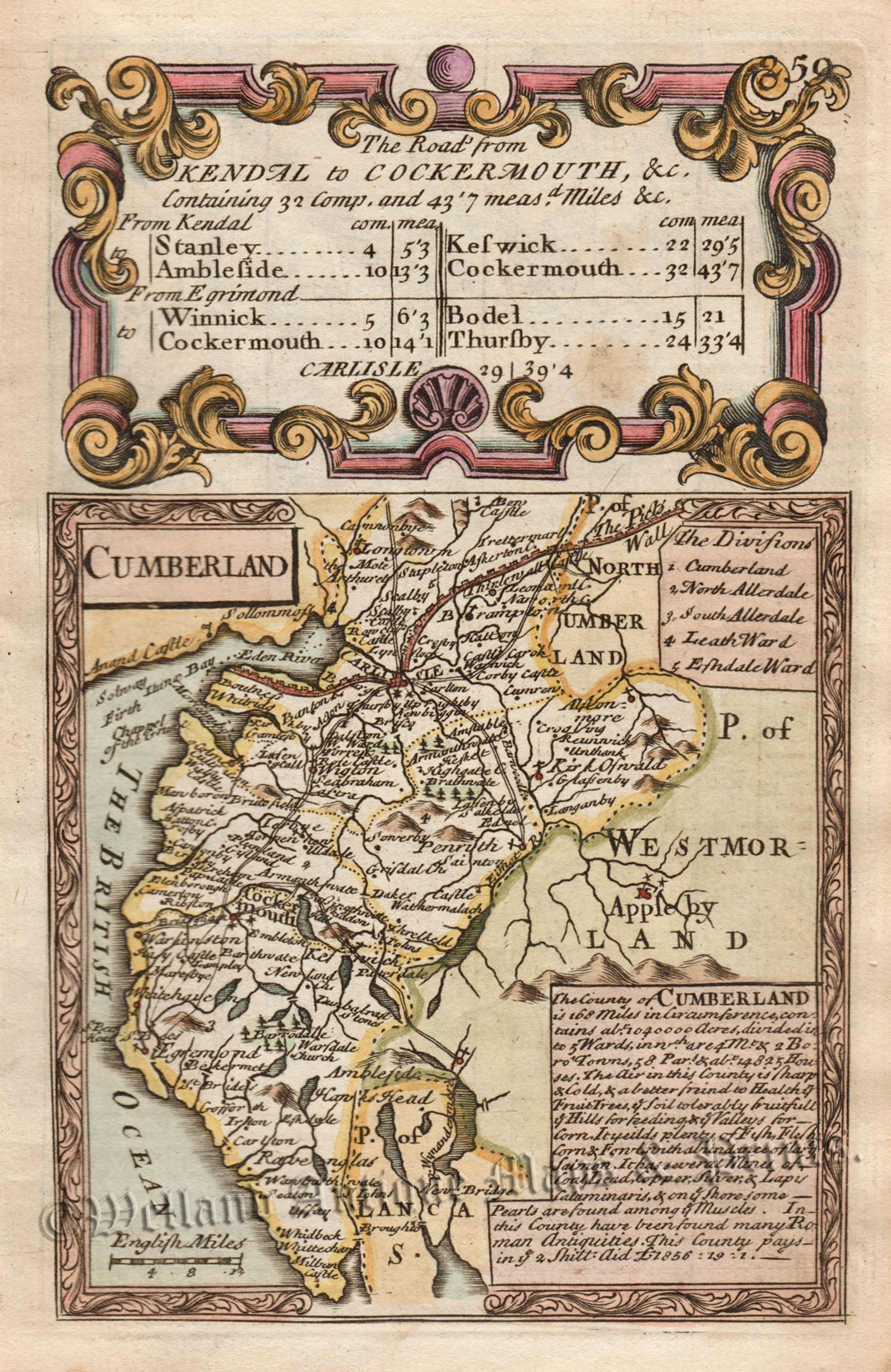
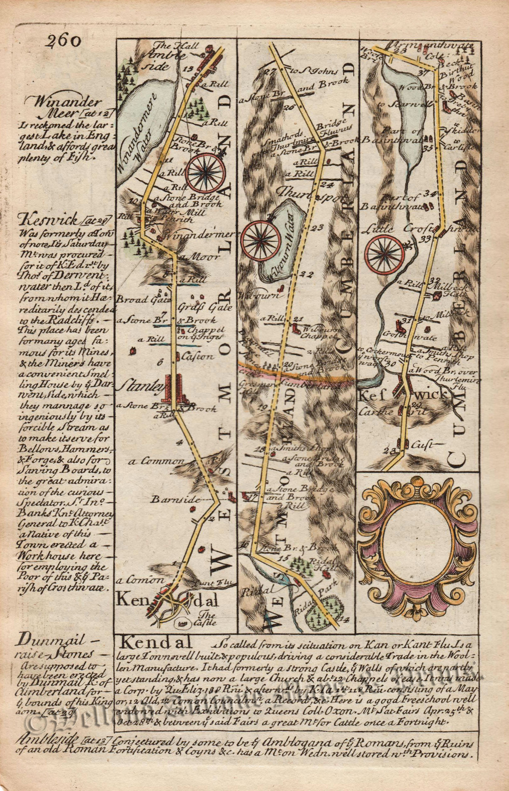
A charming double sided 18th Century map of Cumberland which appeared in John Owen and Emanuel Bowen’s pocket road atlas, Britannia Depicta or Ogilby Improv’d (London: T. Bowles, 1720-1764). On the reverse, there is a strip map displaying the road from Kendal to Keswick.
Britannia Depicta (1720-1764) was one of the most popular atlases of the 18th century being published in many editions for close to fifty years.The maps themselves were engraved by Emanuel Bowen (1694?-1767) who was one of the most renowned and prolific map makers of the period. As with many of his maps, he has included copious amounts of text, written by John Owen, describing the county.
- This is an original copperplate engraving with later hand colour.
- Printed areas are approximately 11.3cms by 18cms for the county map and 11.5cms by 18.2cms for the strip map.
- The map is in very good condition with decent margins. Click on image for better view.
- The item comes displayed in a ready to frame museum quality mount.
- Click on ‘Delivery Policy’ for Postage costs.
- Guaranteed to be at least 250 years old.