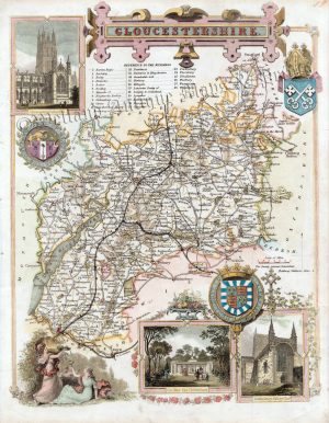
An attractive and detailed 19th century map of Gloucestershire, with a vignette view of Gloucester Cathedral, which was drawn and engraved by Gray & Son and published by Archibald Fullarton & co. in The Parliamentary Gazetteer of England and Wales (London, Edinburgh & Glasgow: 1833-1843). A distinct feature of county maps of this period was the inclusion of the newly built (or proposed) railway lines.
- This is an original steel engraving with later hand colour.
- Printed area is approximately 19cms by 25.2cms.
- The map is in very good condition with excellent margins. Click on image for a better view.
- The item comes displayed in a ready to frame museum quality mount.
- Click on Delivery Policy for postage costs.
- Guaranteed to be over 160 years old.
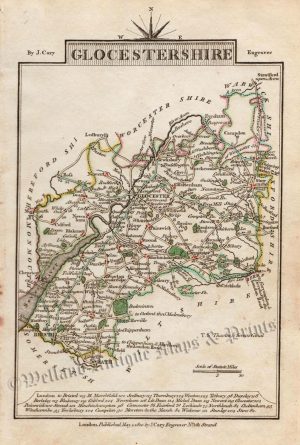
!['GLOCESTERSHIRE' [Gloucestershire] (with full original wash colour) by G. Cole & J. Roper c.1805 / 1810](https://www.wellandantiquemaps.co.uk/wp-content/uploads/2023/01/Gloucestersh-Cole-Roper-03-001-copy_0-300x381.jpg)