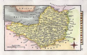
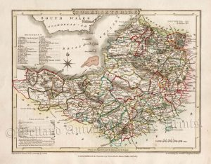
A detailed and attractive early 19th Century county map of Somerset which was drawn and engraved by H. Cooper and published in Benjamin Capper’s A Topographical Dictionary of the United Kingdom (London: G. B. Whittaker, 1824-1839)
- This is an original copperplate engraving with later hand colour.
- Printed area is approximately 18cms by 10.8cms
- The map is in very good condition with decent margins. Click on image for a better view.
- The item comes displayed in a ready to frame museum quality mount.
- Click on ‘Delivery Policy’ for postage costs.
- Guaranteed to be over 170 years old.