Our Range
- Antique Maps
- County Maps
- Bedfordshire Maps
- Berkshire Maps
- British Islands
- Buckinghamshire Maps
- Cambridgeshire Maps
- Cheshire Maps
- Cornwall Maps
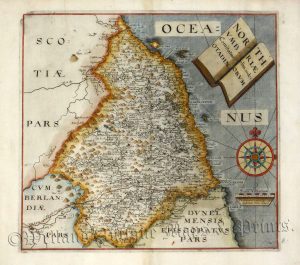
- Cumberland Maps
- Derbyshire Maps
- Devon Maps
- Dorset Maps
- Durham Maps
- Essex Maps
- Gloucestershire Maps
- Hampshire Maps
- Herefordshire Maps
- Hertfordshire Maps
- Huntingdonshire Maps
- Kent Maps
- Lancashire Maps
- Leicestershire Maps
- Lincolnshire Maps
- Middlesex Maps
- Norfolk Maps
- Northamptonshire Maps
- Northumberland Maps
- Nottinghamshire Maps
- Oxfordshire Maps
- Rutland Maps
- Scottish Counties & Regions
- Shropshire Maps
- Somerset Maps
- Staffordshire Maps
- Suffolk Maps
- Surrey Maps
- Sussex Maps
- Warwickshire Maps
- Welsh Maps
- Westmorland Maps
- Wiltshire Maps
- Worcestershire Maps
- Yorkshire Maps
- Foreign Maps
- Great Britain & Ireland with Regional Maps
- Renowned Map Makers
- Road Maps
- Title Pages / Frontispieces
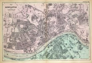
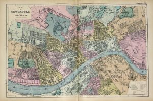
- Town Plans
- County Maps
- Fairy Range
- Other Prints
- Topography