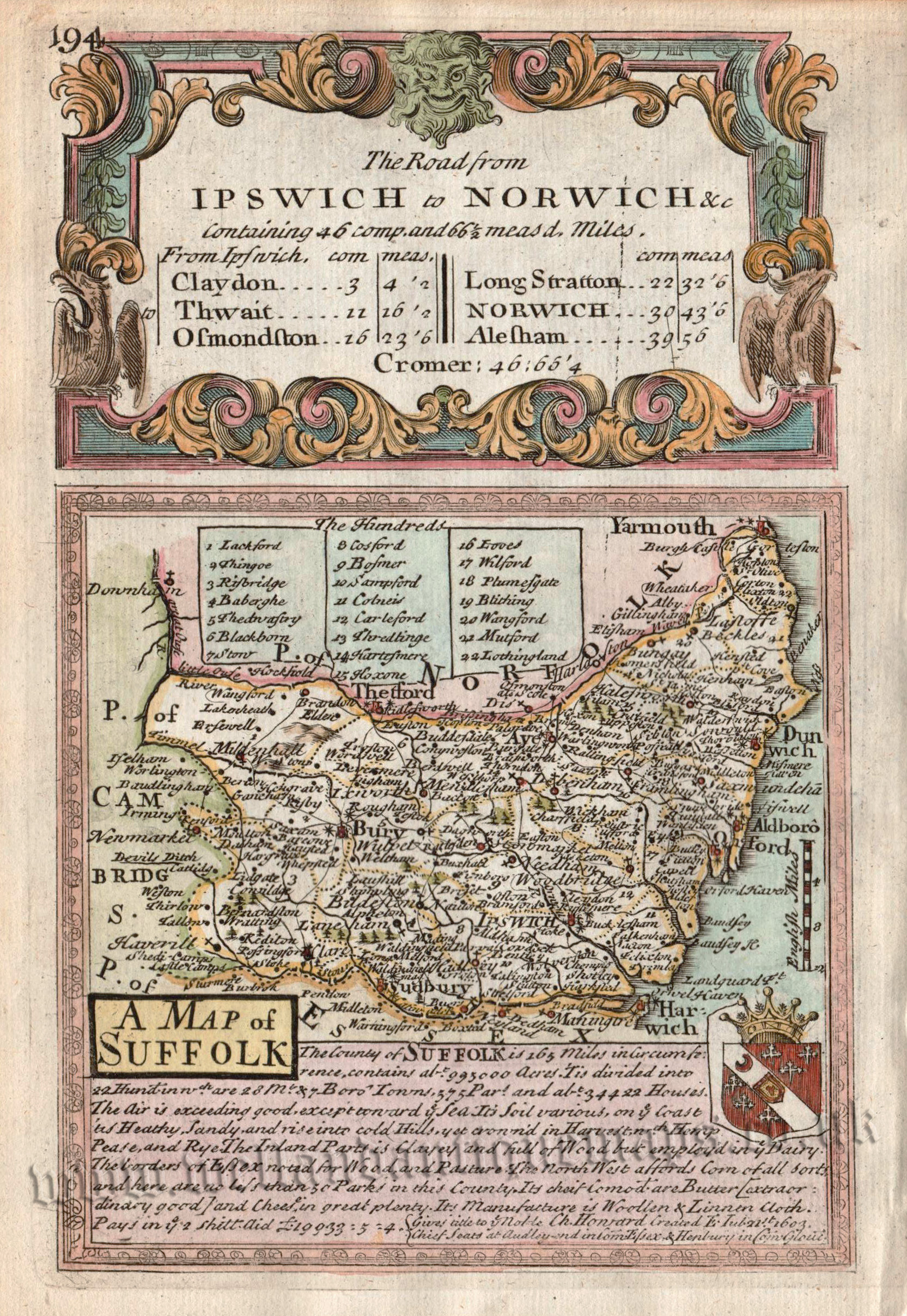
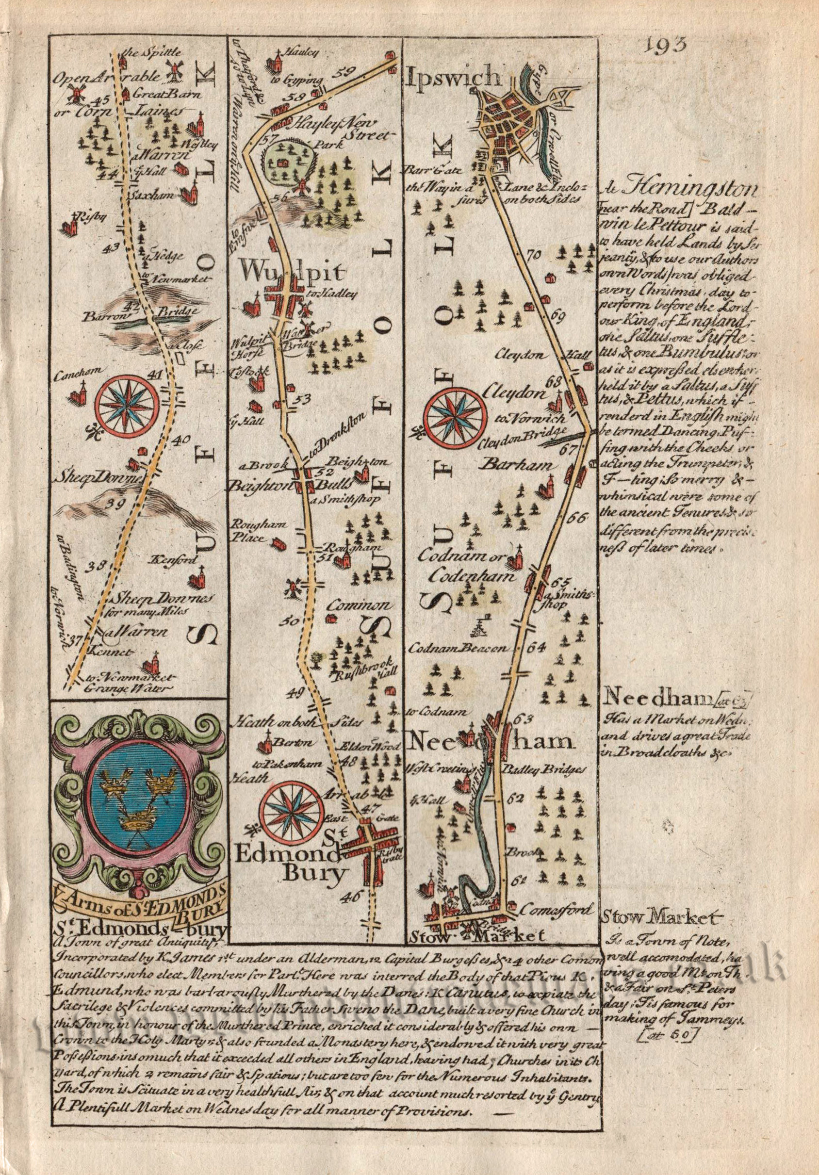
An interesting and charming 18th Century map of Suffolk which appeared in John Owen & Emanuel Bowen’s pocket road atlas, Britannia Depicta or Ogilby Improv’d (London: T. Bowles: 1720-1764). On the reverse of the map the road from Bury St. Edmunds to Ipswich is displayed (see image).
Britannia Depicta (1720-1764) was one of the most popular atlases of the 18th century being published in many editions for close to fifty years.The maps themselves were engraved by Emanuel Bowen (1694?-1767) who was one of the most renowned and prolific map makers of the period. As with many of his maps, he has included copious amounts of text — written by John Owen — describing the county.
- This is an original copperplate engraving with later hand colour.
- Printed area is approximately 11.7cms by 18.3cms.
- The map is in very good condition and is likely from an early edition due to its bold impression. The bottom margin is close, as issued. Click on image for better view
- The item comes displayed in a ready to frame museum quality mount.
- Click on ‘Delivery Policy’ for Postage costs.
- Guaranteed to be over 250 years old.