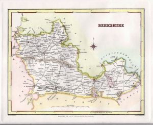
A charming and detailed mid 18th century map of Berkshire which was engraved by G. Rollos and published in P. Russell’s England Displayed (London: 1769). This map was published only once and is rare to find.
- This is an original copperplate engraving with later hand colour.
- The approximate size of the printed area is 25.8cms by 18.4cms.
- The map is in very good condition with decent margins. Minor stains and creases in the paper. Click on image for a better view.
- The item comes displayed in a ready to frame museum quality mount.
- Click on ‘Delivery Policy’ for postage costs.
- Guaranteed to be over 240 years old.