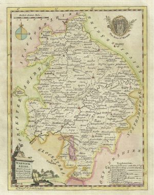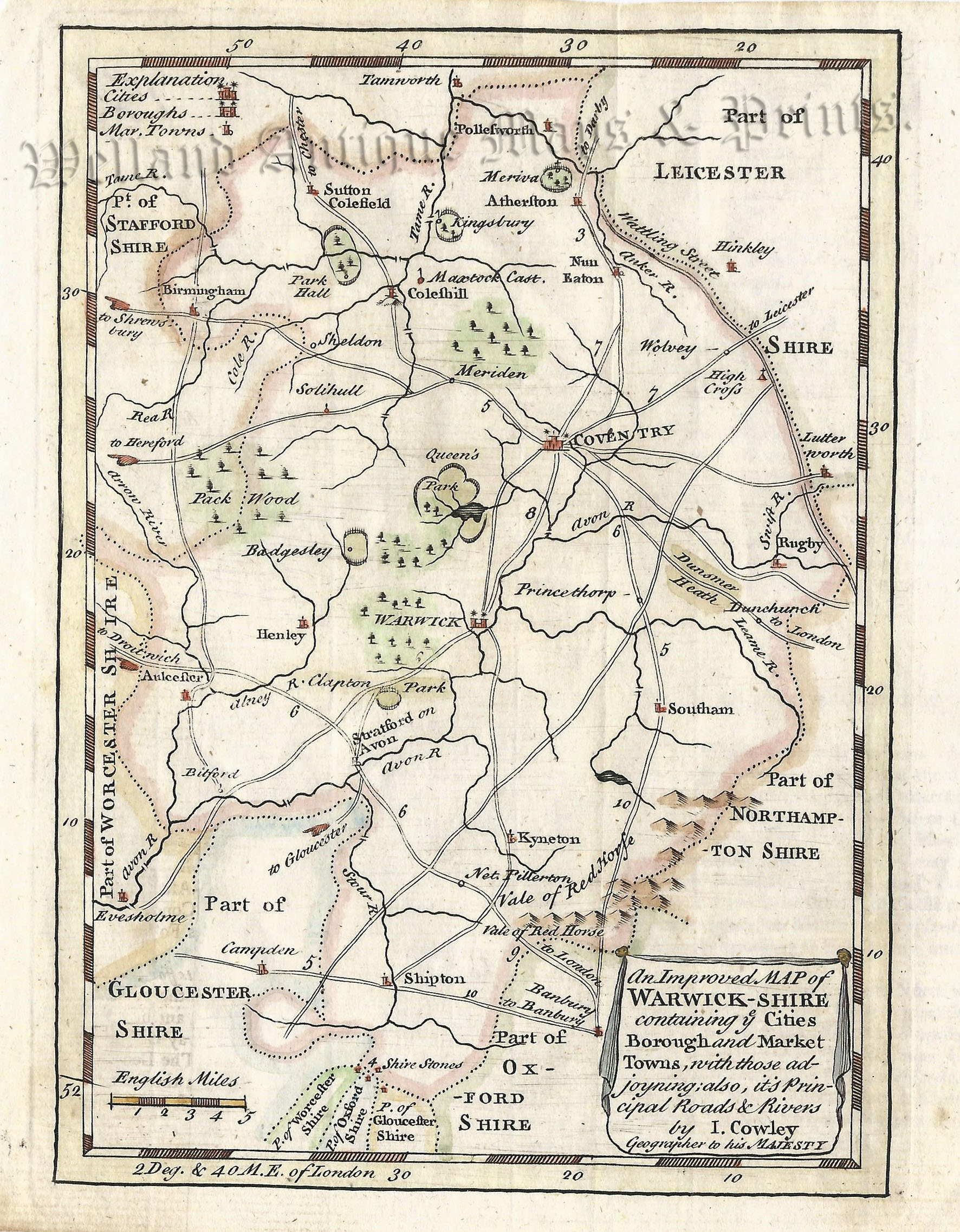
Full Title: ‘An Improved MAP of WARWICK-SHIRE containing ye Cities Borough and Market Towns, with those adjoyning; also, its Principal Roads and Rivers. by I. Cowley Geographer to his MAJESTY’
A rare and attractive 18th Century map of Warwickshire which first appeared in John Cowley’s The Geography of England (London: R. Dodsley, 1741-1744), and then, A New Sett of Pocket Mapps of all the Counties (London: R. Dodsley & M. Cooper, 1745).
- This is an original copperplate engraving with later hand colour.
- Printed area is approximately 13.2cms by 18.3cms.
- The map is in very good condition with adequate margins; fold, as issued. Click on image for a better view.
- The item comes displayed in a ready to frame museum quality mount.
- Click on ‘Delivery Policy’ for postage costs.
- Guaranteed to be over 270 years old.