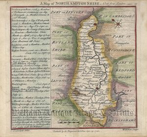
A very rare and attractive early 19th Century map of Northamptonshire, in fine original hand colour and with a decorative vignette of Peterborough Cathedral, which appeared in Langley’s New County Atlas Of England and Wales (London: Langley & Belch, 1817/18).
- This is an original copperplate engraving with original hand colour.
- Printed area with titles is approximately 25.5cms by 19.7cms.
- The map is in very good condition with decent margins. Click on image for a better view.
- The item comes displayed in a ready to frame museum quality mount.
- Click on ‘Delivery Policy’ for postage costs.
- Guaranteed to be over 190 years old.