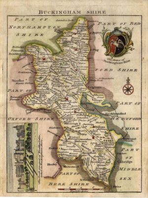
An attractive and detailed 19th century map of Buckinghamshire, with a decorative vignette of Eton, which appeared in Fullarton’s New & Comprehensive Gazeteer of England & Wales (Glasgow: A. Fullarton, 1840s). A distinct feature of maps of this period was the depiction of the newly built (or proposed) railway lines.
- This is an original steel engraving with later hand colour.
- Printed area is approximately 18.5cms by 25cms.
- The map is in very good condition with decent margins. Click on image for a better view.
- Click on ‘Delivery Policy’ for postage costs.
- Guaranteed to be over 160 years old.