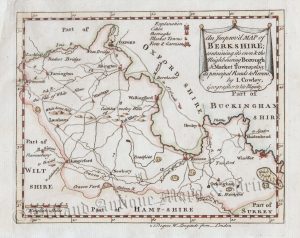
A decorative, scarce and unusual 19th Century miniature map of the counties of Oxfordshire, Berkshire and Buckinghamshire which was drawn by Aristade Perrot, engraved by Adrien Migneret and published in G. B. Depping’s L’Angleterre. Ou Description Historique et Topographique Du Royaume Royaume Uni De La Grande-Bretagne (Paris: 1823-1835). The maps from this series are distinct for their decorative and symbolic surrounds which relate to the counties’ commercial activities, cultural heritage and history.
- This is an original copperplate engraving with original hand colour.
- Printed area is approximately 6cms by 10.5cms.
- The map is in very good condition with decent margins. Click on image for a better view.
- The item comes displayed in a ready to frame acid free mount.
- Click on ‘Delivery Policy’ for postage costs.
- Guaranteed to be over 175 years old.