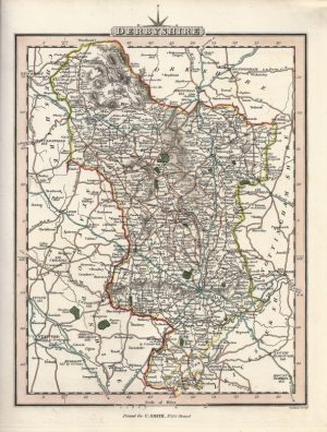
A neatly engraved and attractive 19th Century map of Derbyshire which appeared in Samuel Lewis’s Topographical Dictionary (London: S. Lewis, 131/1837).
- This is an original steel engraving with later hand colour.
- Printed area is approximately 17.5cms by 23.5cms (including imprint).
- The map is in very good condition with decent margins. Click on image for a better view.
- Click on ‘Delivery Policy’ for postage costs.
- Guaranteed to be over 165 years old.