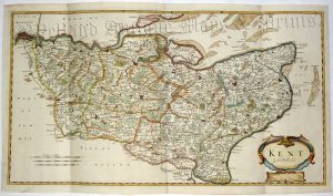
A very rare and attractive early 19th Century map of Kent, in fine original hand colour and with decorative vignettes, which was published in Langley’s New County Atlas of England and Wales (London: J. Phelps, 1820).
- This is an original copperplate engraving with fine original hand colour.
- Printed area is approximately 26cms by 19.5cms.
- The map is in very good condition with fine margins. Click on image for a better view.
- The item comes displayed in a ready to frame museum quality mount.
- Click on ‘Delivery Policy’ for postage costs.
- Guaranteed to be over 190 years old.